December 16, 2022
I didn’t get to visit Green Island.
On December 12th, I woke up at a ridiculously early hour, packed, checked out from the hotel, and got a taxi down to Fugang port, all before 7am.
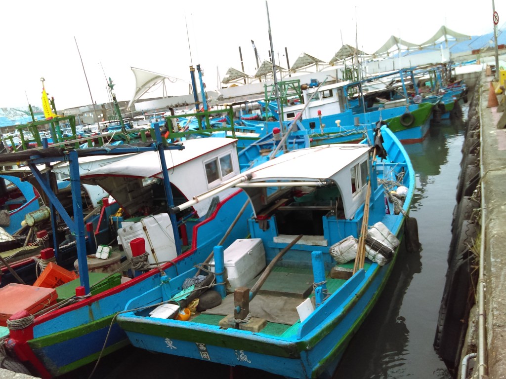
While I was waiting I took some photos (above). There didn’t seem to be any tourists around. Eventually, a lady in a shop explained (in Chinese) that the tourist boats didn’t run that day.
After a bit of thinking, I decided that I wasn’t going to Green Island after all. Once there, I wasn’t certain of returning on the day I chose, and that interfered with my plans, since I had pre-booked my accommodation in Hualien.
So I caught a bus back to central Taitung, via Taitung Train Station where I bought tickets to Hualien. I went back to the same hotel I was in before, and they gave me the same room again. I spent the two days 休息 (xiūxi, “resting”), because of the stroke.
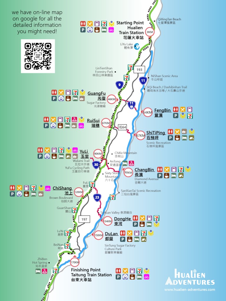
On December 14, I checked out of my hotel for the second time and went to Taitung Train Station, destination Hualien. The above map shows the route, from Taitung in the bottom of the graphic to Hualien in the north.

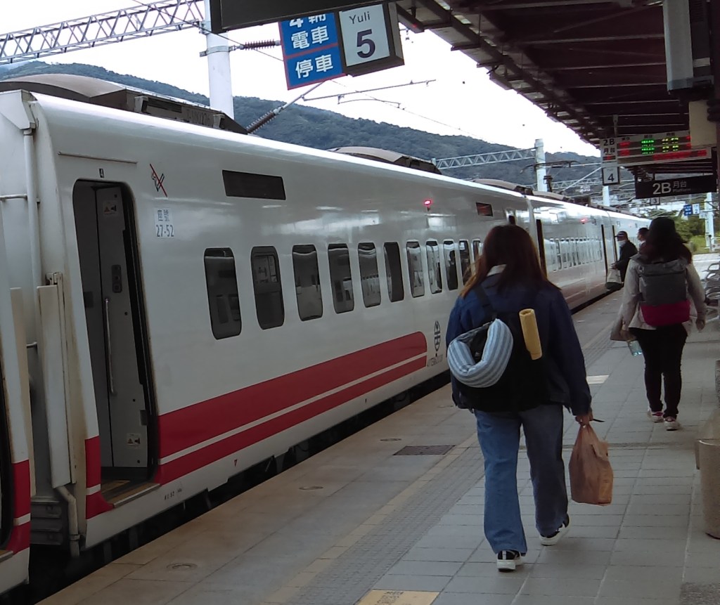
The above shows the train to the left, still in Taitung Train Station. A group of military personnel have just disembarked. The train was only going to Fuli, stopping all stations.

The interior of the train.
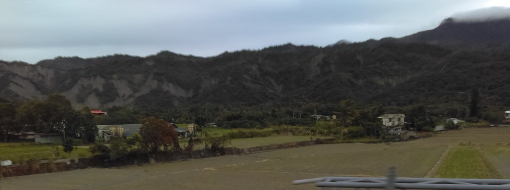
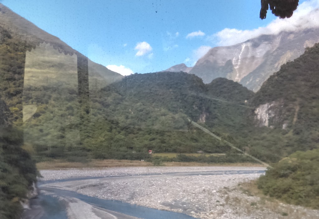
The train went along the East Rift Valley (the roadside signs said so), a straight level way with the mountains to the right and left. Above is a photo taken through the train window – the Philippine Sea Plate side (above) with cloud partly covering the highest parts of the mountain.
According to Wikipedia, the 花東縱谷,”The Huadong Valley or Hualien–Taitung Valley… also known as East Rift Valley or the Longitudinal Valley, is a long and narrow valley located between the Central Mountain Range and the Coastal Mountain Range. It is also recognized as a plain area which stretches for about 180 kilometers near the eastern coast of Taiwan, passes from Hualien City at the north to Taitung City at the south. It was called Nakasendō Plain (中仙道平野, Nakasendō Heiya) or simply Nakasendō during the era of Japanese rule.”
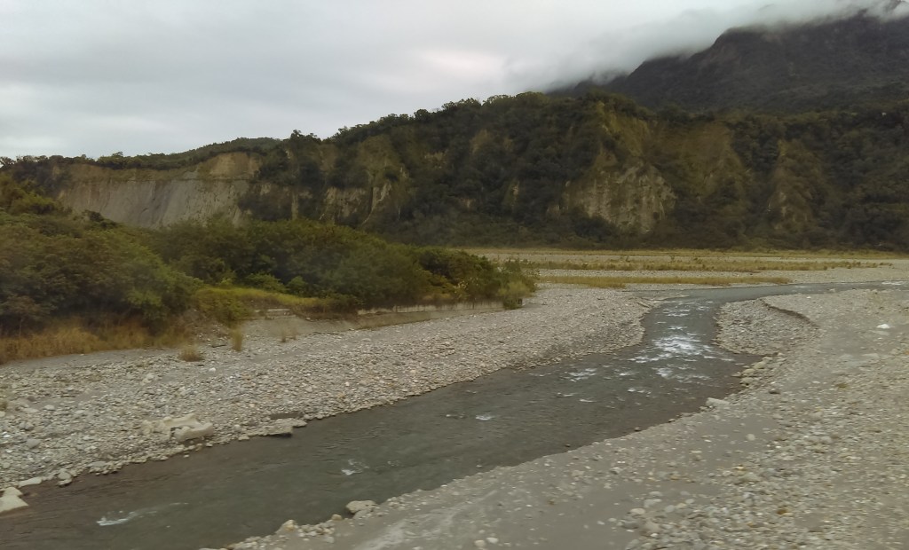
A river (above) running through the East Rift Valley.
According to this webpage, “The Eurasian Plate and the Philippine Sea Plate have been in the midst of a mighty slow-motion car crash for some time now – 15 million years. Stand in the East Rift Valley, look west, and you see the great Central Mountain Range wall. That’s the visible edge of the Eurasian Plate, thrown up from the sea bottom. Look east, at the lower, more rounded Coastal Mountain Range. That’s the visible edge of the Philippine Sea Plate, a former spaced-out necklace of volcanoes far out at sea that has come crashing into Taiwan. The deep seawater-filled trench that once existed between the two has been filled with the materials from mountain collapses and mountain-valley erosion, creating a gently undulating, extremely fertile plain. Each year the Philippine plate encroaches 8cm on its enemy, and each year island Taiwan is thrust 0.5cm higher.”

At Fuli we changed to the bus.

We drove to Yuli Train Station (above), where I bought some food from 7-11 and waited for the second train.
The second train – much better!
I noticed that the scenery changed from tropical at Taitung to subtropical at Hualien; the Tropic of Cancer crosses the route at Riusiu.

Hualien train station. The weather here was slightly colder.

I went literally across the road to my hotel and checked in. The room turned out to be big, so I quickly reserved extra days.

I was here to visit Taroko Gorge (map above). This is a major tourist destination, with accompanying websites and videos.
As always, Nick Kemble has a great guide to Taroko Gorge: “Taroko Gorge, named after the Truku or Taroko aboriginal tribe, is one of Taiwan’s premier scenic attractions. Few visit without being blown away by its sheer magnificence and raw natural beauty. … The area referred to as Taroko Gorge is a steep, dramatic valley carved by the Liwu River (立霧溪), which flows from the Central Mountains of Taiwan to the Pacific Ocean. The blue-green waters of the Liwu have created immense, vertical cliffs of marble and gneiss. … The Japanese first made the area a national park, called Tsugitaka-Taroko National Park, during their colonial rule of Taiwan. The KMT later abolished the national park, and it wasn’t reestablished again until 1986. Ultra narrow Provincial Highway 8 runs up Taroko Gorge. The highway was first built in the late 1950s, and the 212 veterans who died while building it are today commemorated at Eternal Spring Shrine.”
YouTube has many videos of Taroko National Park and Gorge. I chose the one above because of the absence of a narrator, plus the spectacular drone footage.

On December 16 it was a sunny day. The mountains behind Hualien Train Station (above) looked spectacular! I couldn’t capture the splendor adequately on my mobile phone.
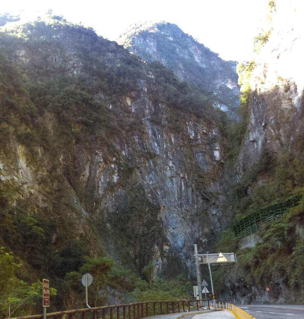
I boarded the bus and took photos out the window (above).

… and the front of the bus.
Wikivoyage said “The most phenomenal aspect of the park is the amazing relief. In a single afternoon you can travel from rugged coastal cliffs through a maze of subtropical forested canyons to high elevation sub-alpine coniferous forests. In about 60 km the landscape rises from sea level to some of the tallest peaks in Taiwan at over 3400 m. That’s steep! The force behind the steep valleys and narrow canyons is a (geologically speaking) relatively fast rate of uplift combined with ample water. Over the last 70 million years, these two forces collaborated to form the world’s deepest marble canyon. The slot canyons here are remarkable with narrows sections 300 m high and only a dozen meters apart”.
I alighted the bus at the Tunnel of Nine Turns.
The Taroko National Park Headquarters said “The Tunnel of Nine Turns (Jiuqudong) is considered one of the most scenic sections of Taroko Gorge. The number nine in Chinese—implying ‘many’—is heavily used in the Chinese language. The trail itself is 700 m one-way in length, and visitors enter and exit from the West entrance. The Tunnel of Nine Turns meanders high along the mountains, where visitors can experience an impressive view of the Liwu River from an imposing height. Here, the narrow Gorge with its steep sides close to each other presents a thrilling, majestic landscape.”

The entrance to the Tunnel of Nine Turns. At the bottom left is a toilet block.
Taiwan Public Television Service said visitors suffered from many falling rocks, so Taroko National Park Management closed it for 6 years; it re-opened in 2019, and now no hard hat needed by tourists.
Another webpage at the Taroko National Park Headquarters said: “The Tunnel of Nine Turns (Jiuqudong) Trail used to be part of the old Central Cross-Island Highway (Provincial Highway 8). In order to relieve the traffic of Central Cross-Island Highway, allow the tourists to enjoy the view of the gorge, and ensure tourists’ safety, Taroko National Park Headquarters devised the plan of vehicle-pedestrian separation. In 1996, Tunnel of Nine Turns (Jiuqudong) Tunnel was open for vehicles, whereas the original section of Central Cross-Island Highway was transformed into a walking path for pedestrians, which allows tourists to enjoy the scenery of Taroko Gorge at ease without the interference of vehicles. The 1,220m-long Tunnel of Nine Turns (Jiuqudong) Tunnel is the longest tunnel of the Central Cross-Island Highway, while the 700 meters long Tunnel of Nine Turns (Jiuqudong) Trail is the best part of Taroko Gorge. The trail snuggles against the tall mountain and deep gorge. If you look down, you will see Liwu River gushing swiftly past the mountain walls facing each other so closely. You will be astonished at the craftsmanship of nature that has created these treacherous terrains.”

The Tunnel of Nine Turns isn’t really a tunnel; it has apertures on the side so you can see out. The views are stupendous – see above for an example. This is a world-famous site.
After that I took the bus back to Hualien.
