April 4th, 2024
Recently I have been meeting with 櫻婷 (Yīng Tíng), English name Wren, to practice Chinese. Last week, 櫻婷 said to me, what will you do for the holidays? What holidays? I looked on the Internet, and sure enough, there was a holiday, Qing Ming Festival (also known as Tomb-Sweeping Day) coming in only a few days. On reflection, I thought I’d always wanted to see the Yang Ming Shan (陽明山) area, on the northern outskirts of Taipei, so I went there.

Here’s the Google Maps plan of Yang Ming Shan, centered upon Yangmingshan National Park. By the way, in writing this webpage I found the website The Ultimate Yangmingshan National Park Guide from Nick Kembel valuable, particularly for finding out the names of natural attractions.
Yangmingshan National Park only dates from 1985. The Yangmingshan National Park website says that during the Japanese Occupation Period, the government chose a part of Datun Volcano group as the site of the “Datun National Park,” but after the start of the Second World War the plan was suspended. In 1963, the newly independent government tried again, creating the “Yangmingshan National Park”; that too was suspended. In 1985 the Yangmingshan National Park plan was finally promulgated. The place is named for Wang Yangming, a Ming dynasty general and famous Neo-Confucian philosopher.
I went online and booked a ticket for Yangmingshan and Beitou – I couldn’t get only Yangmingshan. In return I was given an itinerary with times and places, with the attractions at Beitou coming first.

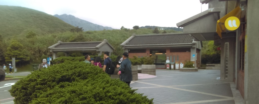
The ticket directed me to Zongxiao Park (忠孝公園) directly in front of the Zhongxiao Xinsheng (忠孝新生) MRT where I would be picked up. It turns out, several different companies use this as their meeting point at the same time. There were tourists (above) and tour guides moving from group to group, holding pages of printed names, trying to get their groups together.

We boarded a bus exactly like the above photo (but it’s not). The tour guide disregarded the itinerary and took us out of order.
As you would expect, there are many YouTube clips of Yangmingshan. I selected the one above as it conveys a good feeling of Yangmingshan as a place.
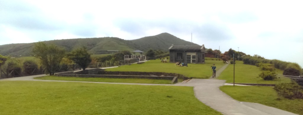
The bus drove up and up into the mountains. At the end of a dead-end road stood the Qingtiangang Visitors Center (above). This was our first stop.

The Qingtiangang Visitors Center was surrounded by picturesque mountains (above). Qingtiangang means “Hill Holding up Heaven” referring to the KMT Qingtian garrison here. According to a plaque here, Qingtiangang is a lava plateau. During the Japanese occupation this was an important place for cattle pastures, and gazing turned the area into grassland – hence the name, Qingtiangang Grassland. The height is about 770 meters. It was an important route for the pioneer settlers.
There are apparently water-buffalo in Qingtiangang, although I didn’t see any of them. The Foreigners in Taiwan website says “The water buffalo at Qingtiangang are actually closely watched and cared for. Although they roam free around Yangmingshan, they are watched over by the Agricultural Associations of Jinshan, Shilin, Yangmingshan, and Beitou, and well as the national park management. In the winter of 2020 which was unusually wet, tens of cows began to die of malnutrition, therefore the park took steps to supplement the diet of the remaining cattle. Many cows were brought to lower eve lavations for rehabilitation before being released back to Yangmingshan. “
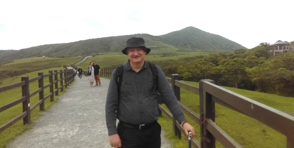
Me, taken by the tour guide.
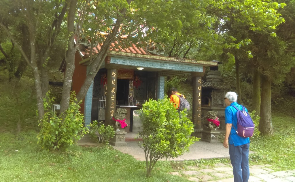
According to the accompanying plaque, the small temple in the photo above honors the Earth God. It’s actually two centuries old and quite famous. The two people are paying respects.

We boarded the bus and drove a short distance to Lengshuikeng Hot Springs (冷水坑溫泉浴室). The Chinese name means “cold water pit”.

The foot dipping pool. According to The Ultimate Yangmingshan National Park Guide there are separate bathhouses where you can enter the spring water, but I didn’t go there.
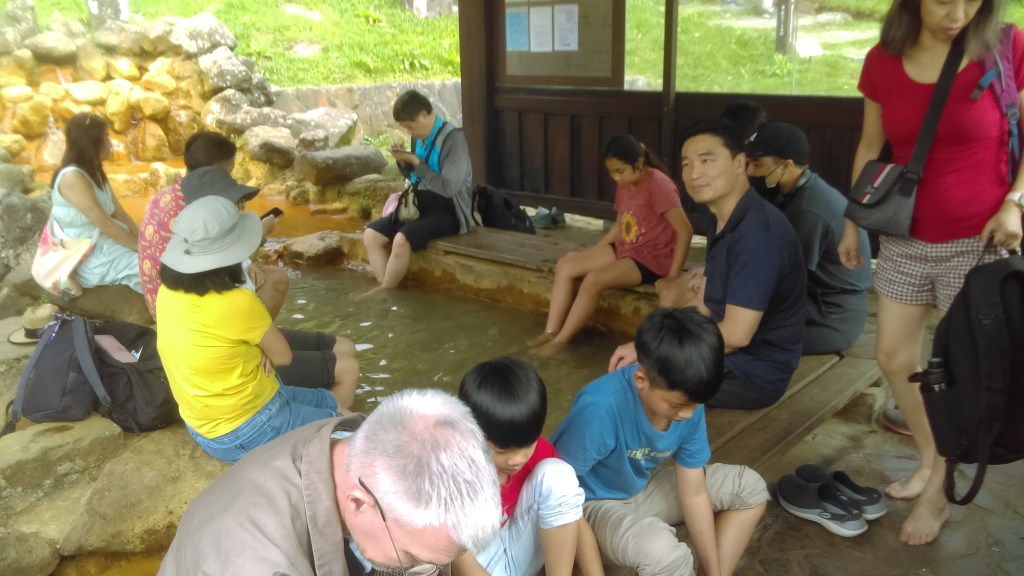
The attraction here is that you can put your feet in the hot springs. I didn’t join the group soaking in the springs, but I tested it by putting my finger in the pool – only lukewarm water (40 degrees according to this site).
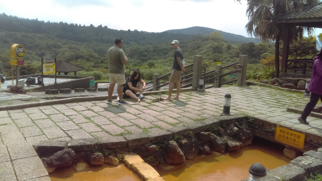
There is a fine view across the valley.
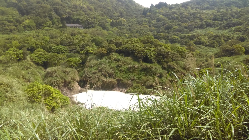
We walked a short distance to Lengshuikeng (冷水坑). I photographed the Milk Pond (above).

The pond does not contain milk. The plaque above lets you in on the secret.

Stupendous views at Lengshuikeng.

I crossed the suspension bridge. Later I found a website by a person using a wheelchair that gives detailed impressions of Lengshuikeng and this bridge.

That’s me, taken by an acquaintance.

There was a track that led through the woods to a pond (above). Quite a pretty journey.
Next stop: Yangmingshan Shuwu. We didn’t see much, but we heard the tour guide speak about the sons of Chiang Kai-shek and some of the shenanigans instigated by them.

I took this photo as I was hurried out.
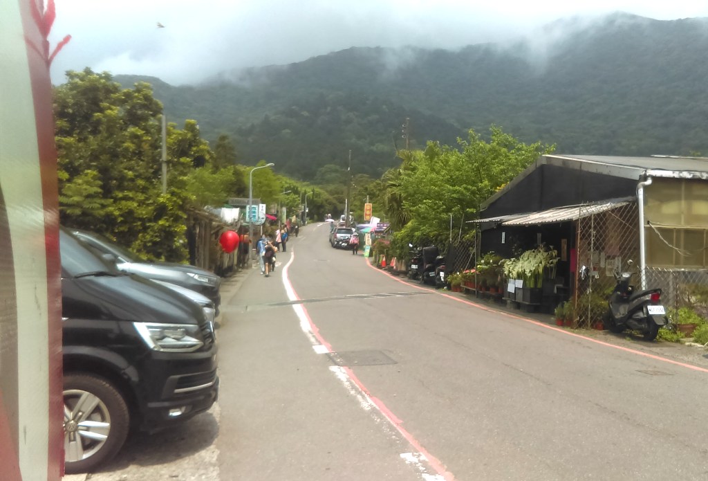
Next stop: lunch. We drew up at a “village”. It was all restaurants, set up for this purpose, with enormous rows of tables after tables. The food was overpriced, but quite plentiful and delicious.

Afterwards I walked around the “village” and took photos (one of which is above) while waiting for the bus.

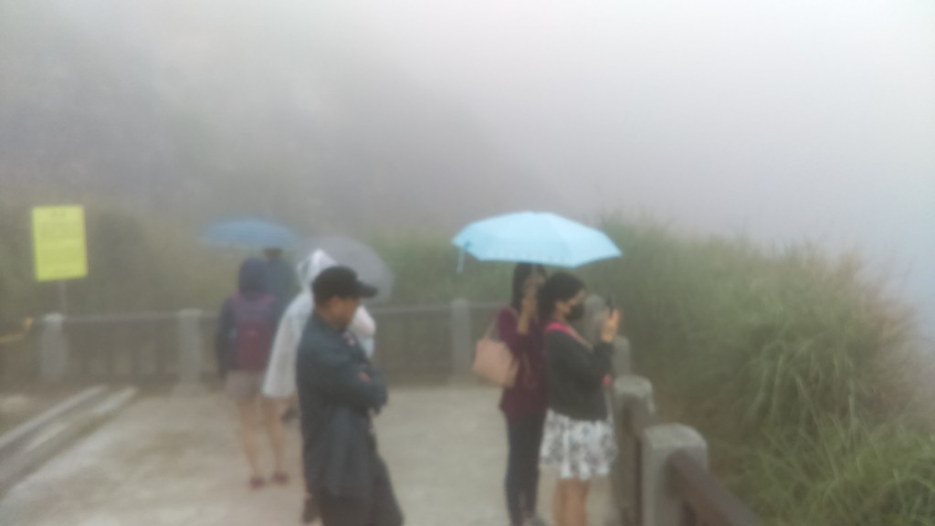
After lunch we went to Xiaoyoukeng (小油坑). The road went up into mist and light rain, with fog so thick that it bottled out the view. That isn’t trick photography in the above picture, it really was foggy!
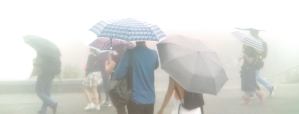
The rain was light but constant, but I elected not to put up my umbrella, taking refuge beneath my hat.
Xiaoyoukeng smelled strongly of rotten eggs, because of the sulphur. The Yangmingshan National Park website says “Before the Han Chinese people settled in the area, the Datun Volcano Group was the traditional hunting ground and traditional sites of the ancestors of the northern Plains indigenous tribes and the mid-to-late-age Shihsanhang culture people. Aside from hunting and gathering, these people also mined sulfur to trade with Chinese merchants, the Spanish and Dutch. … [F]earing that local people may engage in the manufacturing of illegal gun powder for use in uprisings, the Qing Court ordered the banning of sulfur mining after the Lin Shuang-wen Rebellion of 1786. The sulfur mines were guarded by garrisons, and the surrounding areas were periodically burned during each year. By 1877, Qing officials Ding Ri-chang and Shen Bao-zhen petitioned the Qing Court to relax the ban on sulfur mining, and the government hired workers to mine and refine sulfur. In 1886, Liu Ming-chuan, the Governor of Taiwan, formally requested the establishment of a Sulfur Commission in Taiwan to oversee the mining and trading of sulfur. Since that time, sulfur has become one of the Four Commodities of Taiwan, along with camphor, tea, and sugar.”
The end of the walkway. Thick fog surrounded us, preventing any view, although I could hear a constant roaring sound. The view on a clear day would be the first picture of something like this.

There was a small fumerole just near the path. In the above photo, the mud to the right of the yellow sign is boiling.
Unfortunately, I began to get tired. At the next stop I rested inside the bus. We headed for Beitou, but I had already seen Xinbeitou in a post on this website, so I was dropped off at Xinbeitou, near the Beitou Hot Spring Museum, and headed home.
