Manly, Australia

August 26, 2025

I’m in Sydney for a week, in between my MTC classes. I’ve been doing the classic tourist sightseeing in Sydney. This journey I decided to go to Manly.

I started at Circular Quay (pronounced “Key’) in the Central Business District, took a ferry to Manly Wharf on the harbour side of Manly, then walked to Manly beach.

Tuesday was a brilliant day: clear sky, a little cold in the morning (16 degrees Centigrade) but warming up to the low 20’s. It felt like spring, even though we were in the last week of winter. (A few days later, it was back to winter again, with big falls of snow in the Snowy Mountains.)

Circular Quay, the walking-only promenade next to the harbour. In the above photo the Quay actually juts out into the harbour – beneath those people is deep water. To the left, a restaurant with sky-high prices (but it’s on Circular Quay!)

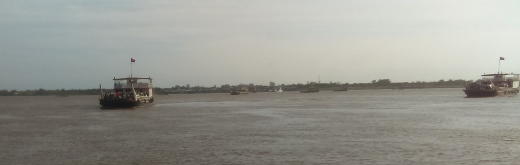
A close-up of some ferries.

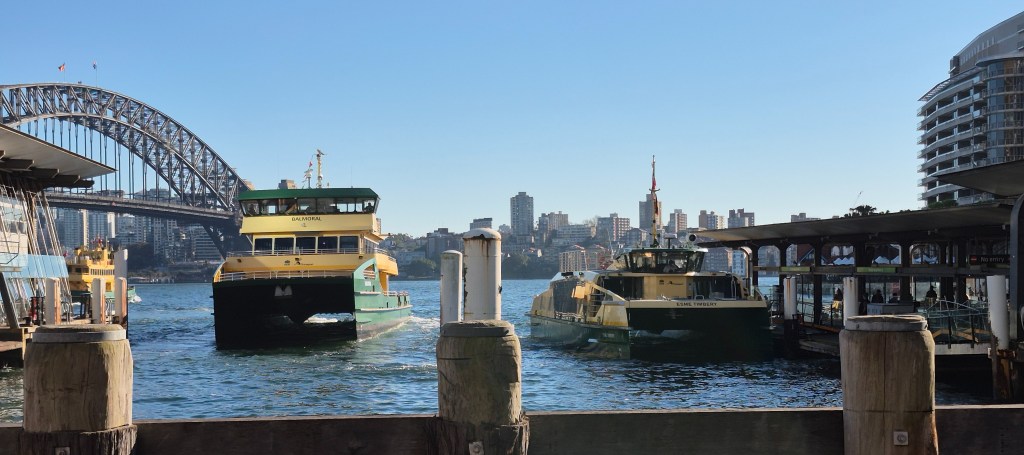
Another view of some ferries. Incidently, why is it called “Circular Quay”? Wikipedia says “The harbour was originally known as ‘Semi-Circular Quay’, this being the actual shape of the quay. The name was shortened for convenience.”

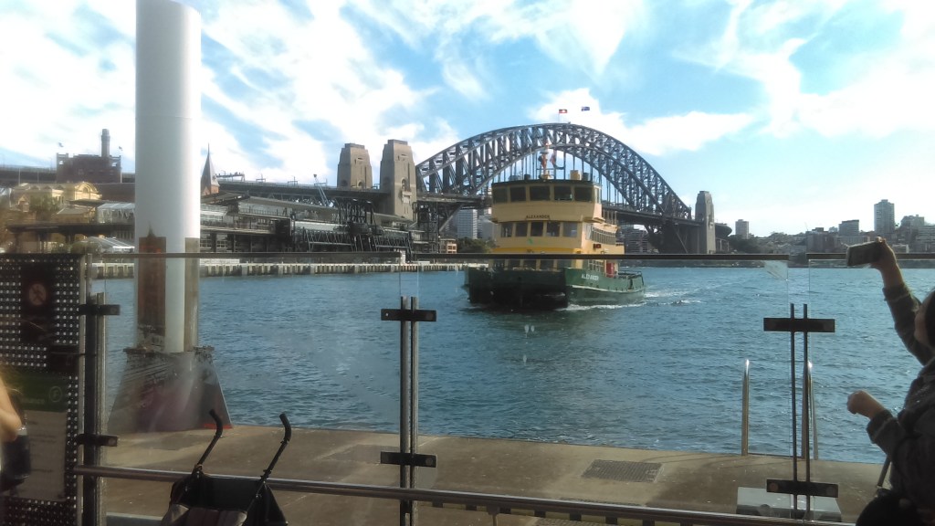
The Sydney Harbour Bridge. I did a post covering this.

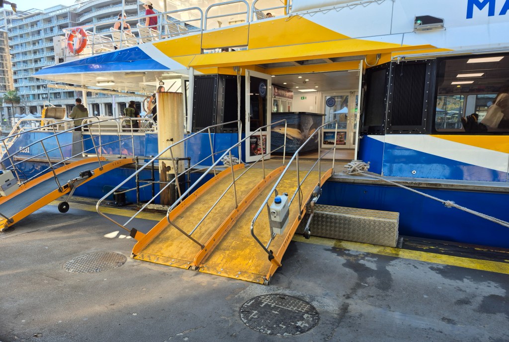
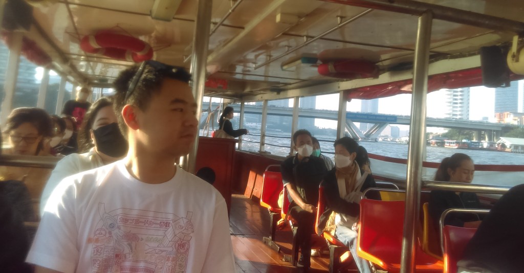
The Sydney Fast Ferry was leaving in a few minutes. I just had time to snap a picture above.

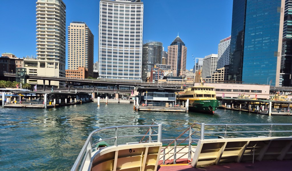
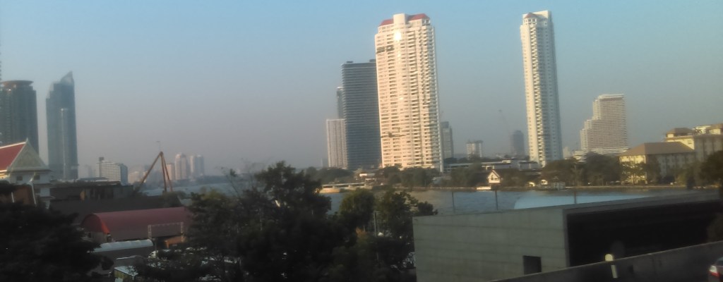
We’re off! Well, no – this photo was taken coming back to Circular Quay after visiting Manly, but I didn’t have a photo capturing this period going out.

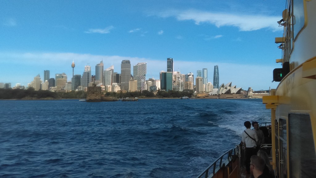
It’s a beautiful day, the air is fresh and clear, Sydney sparkles.

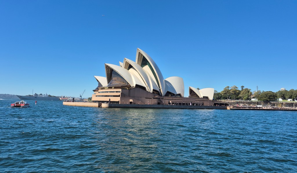
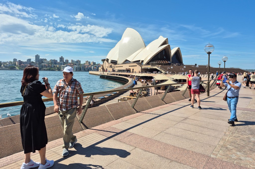
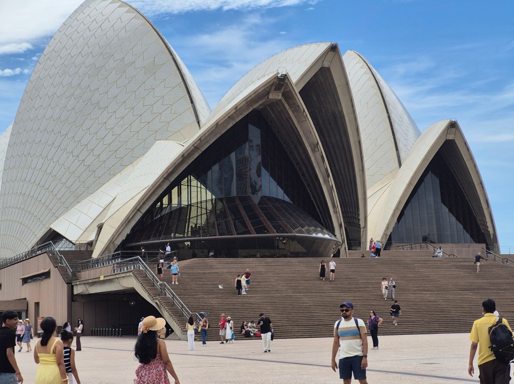
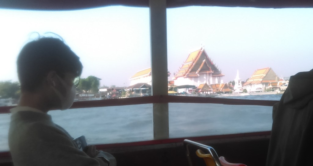
The Sydney Opera House. I did a post on this. Actually when I took this photo I was on my way back to Circular Quay.

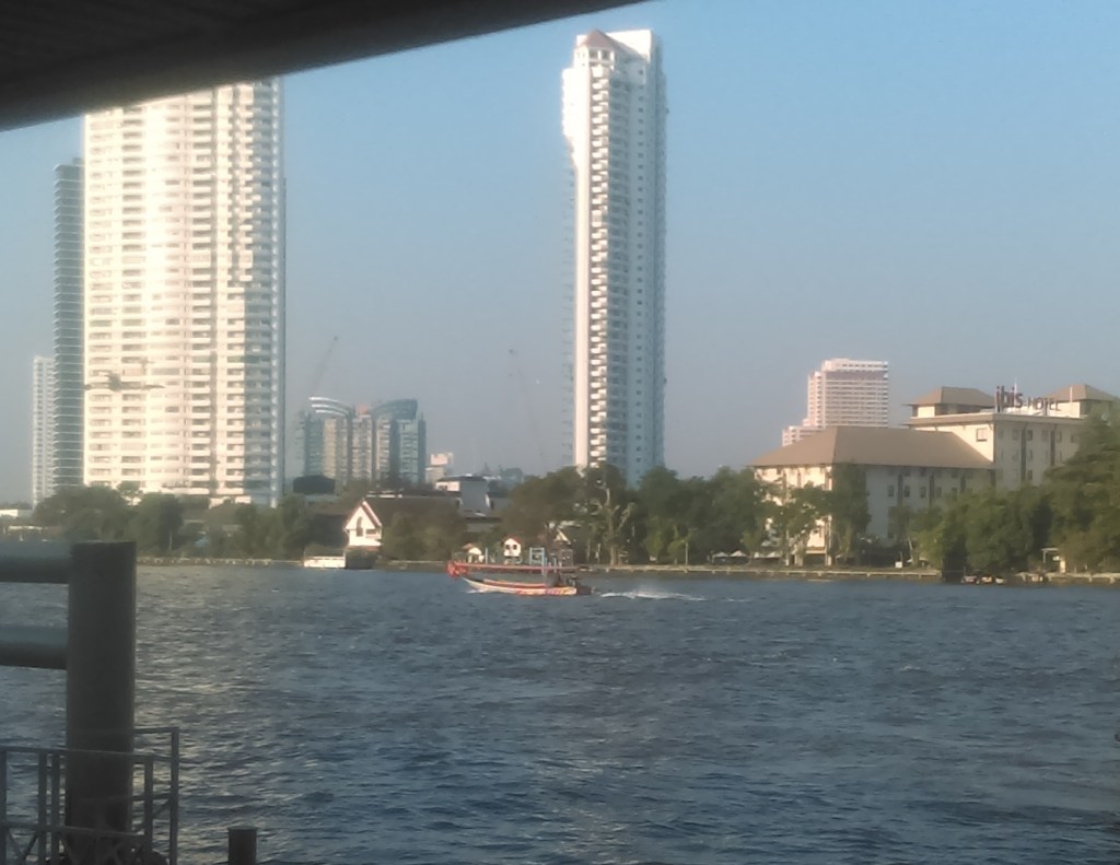
Here is a photo when I was going out to Manly.

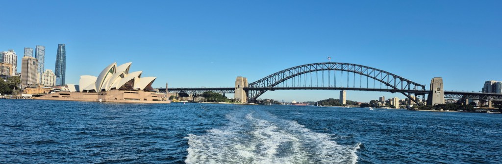
A fine view of the Sydney Opera House and the Sydney Harbour Bridge in bright sunlight.

Admiralty House ” is the Sydney residence of the Governor-General and one of the most historic and important residences on Sydney Harbour. The iconic property is used by the Governor-General as both a residence (when they are not at Government House, Canberra) and to host thousands of people every year … It was renamed Admiralty House in 1885 when the colonial government purchased it as a residence for the Admiral of the Royal Navy’s Australian Squadron. … Admiralty House was handed to the Commonwealth Government in October 1913 and became the official residence of the Governor-General.”

There were other people snapping photos as well.

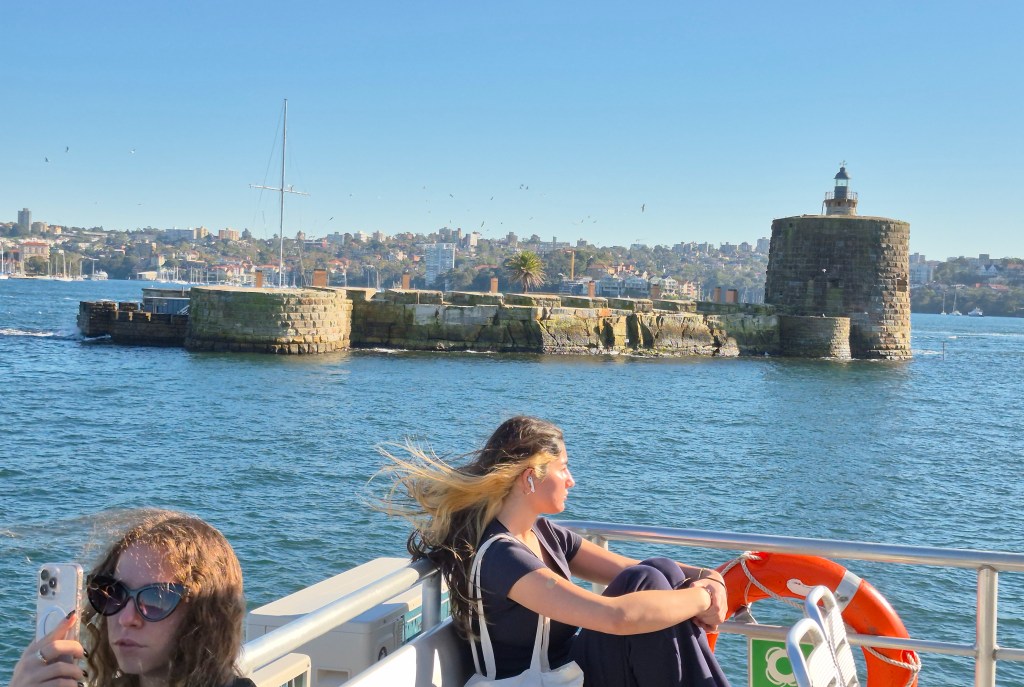
Fort Denison. I wrote about it on this page.

A fine view of the foreshore.

Shark Island, “an attractive and picturesque island of shady trees, sandstone grottoes, grassy slopes and small sandy beaches. It gets its name from the fact that its outline is vaguely similar to that of a shark. ‘Boambilly’ was its Aboriginal name. … With views stretching towards the Harbour Bridge and the white sails of the Opera House in one direction, and over to Manly and the Heads in the other, Shark Island is quite possibly the most precious jewel in the crown of the harbour.”

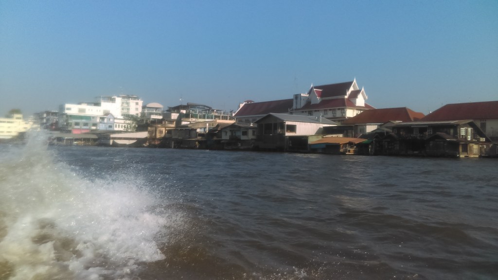
The ferry turned to head north, and the headland cut off my view of Sydney.

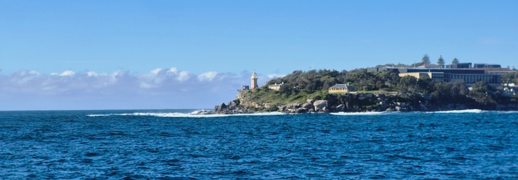
South Head. Beyond is the Pacific Ocean, until South America.

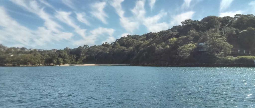
On the other shore it’s all wild bush. Google says “Residential development has impacted a significant amount of the harbour foreshores over many years. Much of what remained was preserved partly due to the presence of military bases, and partly because of the work of conservationists … The Sydney Harbour National Park was finally gazetted in 1975 … the historically important quarantine station at Manly was added in 1984.”

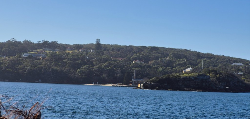
The Quarantine Station. “Between the 1830s and 1984 every migrant ship entering Sydney Harbour was required to be cleared of infectious diseases before the passengers were able to land. If disease was suspected on board both the sick and the healthy were sent to the quarantine station. Some … spent only a few days there, some spent many months and others, more than 500 in all, died. They died of terrible diseases, the mere names of which conjure up images of suffering and desolation – diseases such as smallpox, bubonic plague, typhus and Spanish flu. The healthy were segregated from the sick which meant that those who died often did so alone without the comfort of family or friends. … Q Station has a reputation as the most haunted place in Sydney.”
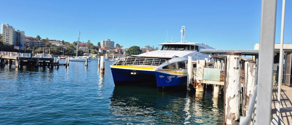
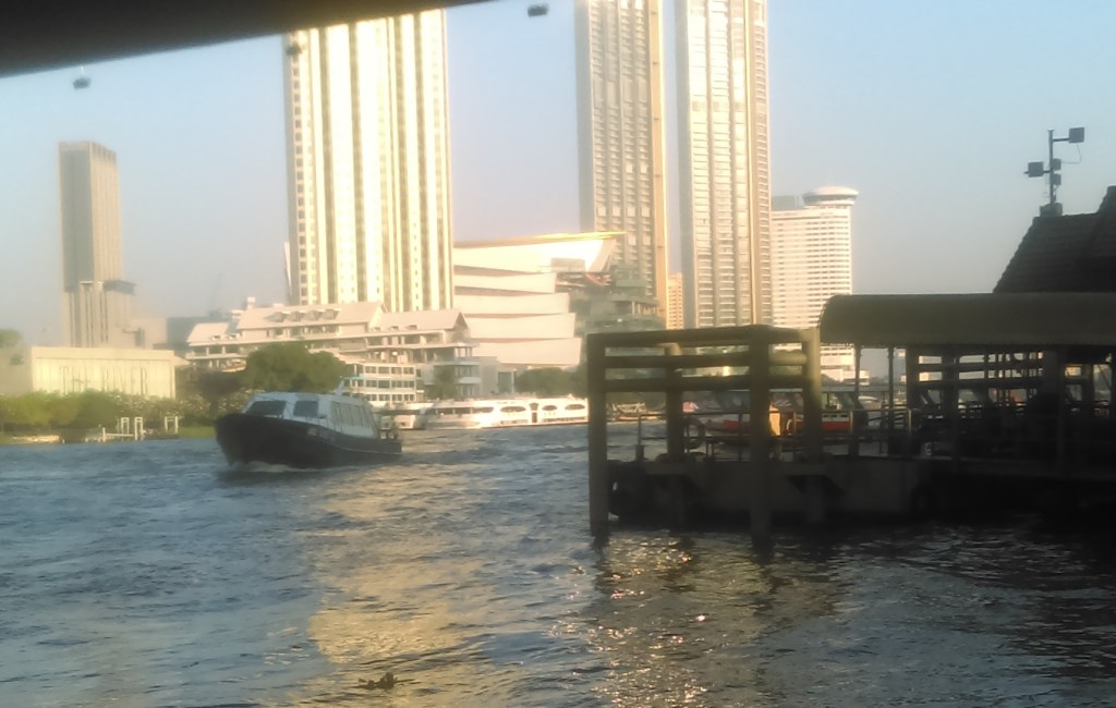
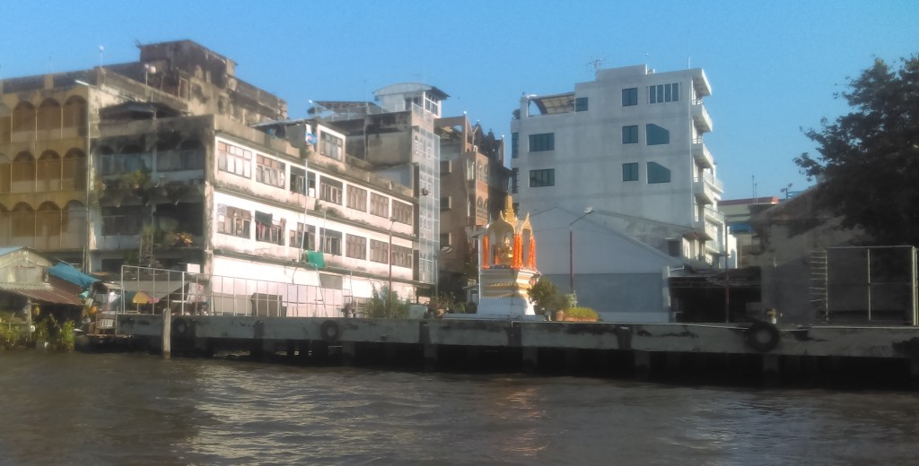
Coming into Manly.

Almost at Manly Wharf.
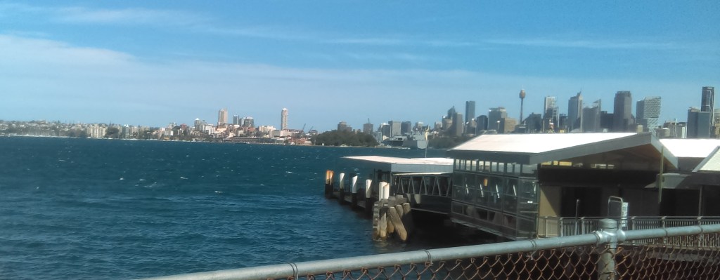
Manly Wharf.

People walking off the ferry, including a cyclist

Manly Wharf is built out over the harbour (as is Circular Quay). The photo above looks down into the green murky waters.

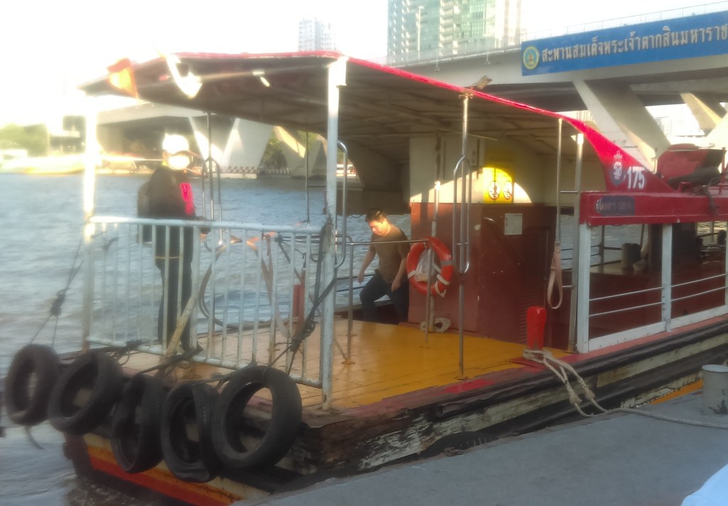
I rushed to get on the Manly Fast Ferry so I didn’t have a photograph. Here’s one as I was leaving.

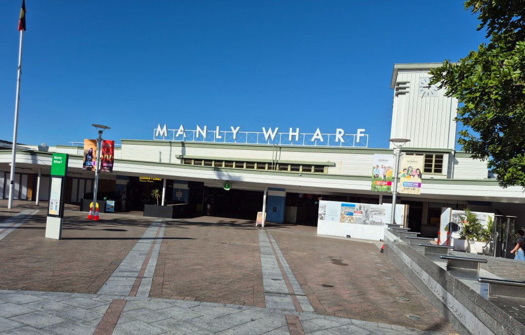
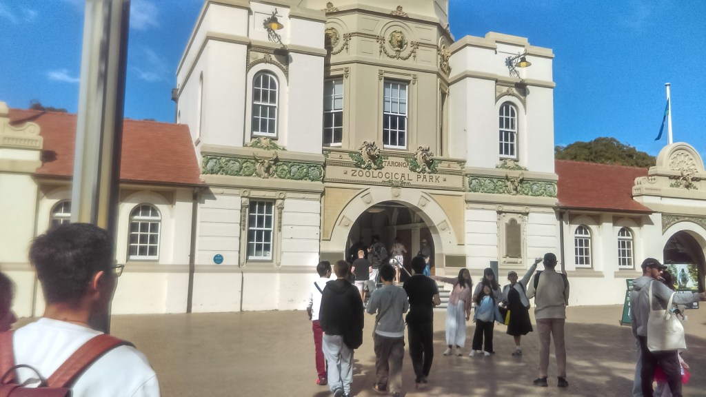
The entrance to Manly Wharf.

There are many, many clips on YouTube about the Circular Quay – Manly route, but there are not many clips that don’t show the influencers. Here is one.

Outside Manly Wharf there was quite a pretty view.

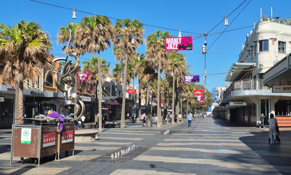
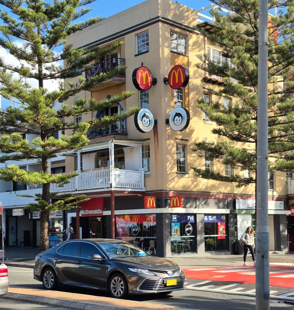
Not far away is Manly Beach (600 meters according to Google Maps) along the Corso.

This section of the Corso is partly pedestrianized. There is a huge fig (above) which spreads out above filling the road.

ManlyAustralia.com says “The Manly Corso was laid out in 1854-55 by Henry Gilbert Smith, originally built as a boardwalk for early tourists across Manly’s sand spit between the harbour pier and the beach. The Corso remains the focal point of Manly as a part-pedestrian mall lined with popular surf shops, pubs, cafes, galleries, and street entertainment. Most of this street has no vehicular traffic making it a broad pedestrian precinct for shoppers and visitors and the quickest route from the Manly Ferry to Manly Beach.”

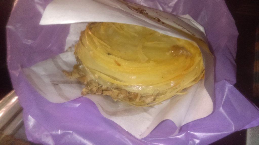
The Vietnamese bánh mì, Sydney’s unofficial favourite meal.

The easternmost end of the Corso.
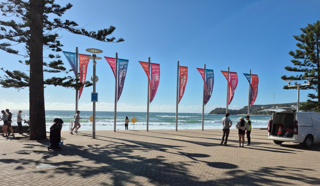
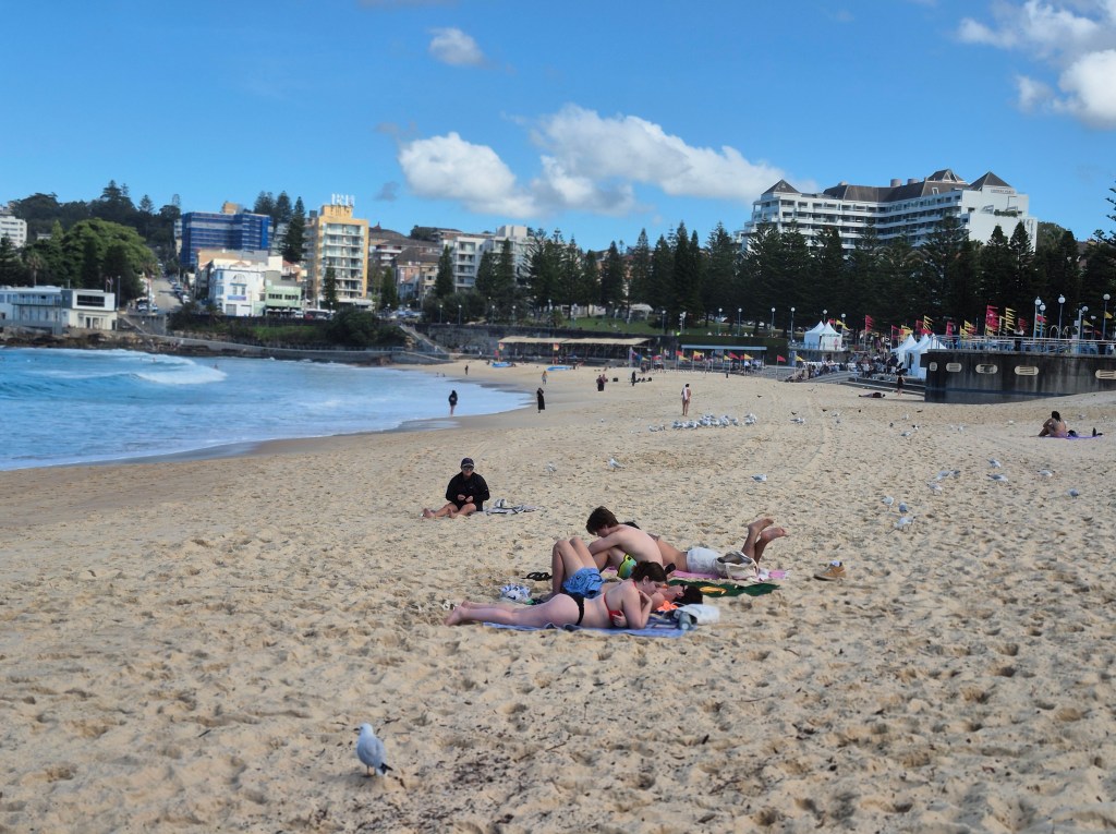
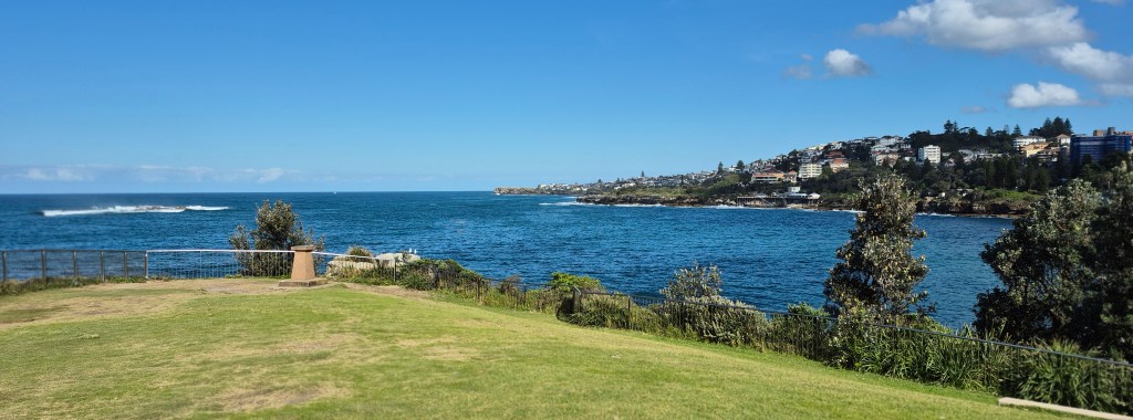
Manly Beach.

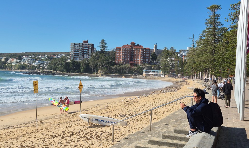
Looking to the right on Manly Beach. Those signs say “Beach Closed”, due to the heavy waves, but two female surfers are heading out regardless. In the upper left of the photo is Cabbage Tree Bay and Shelly Beach.

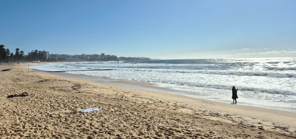
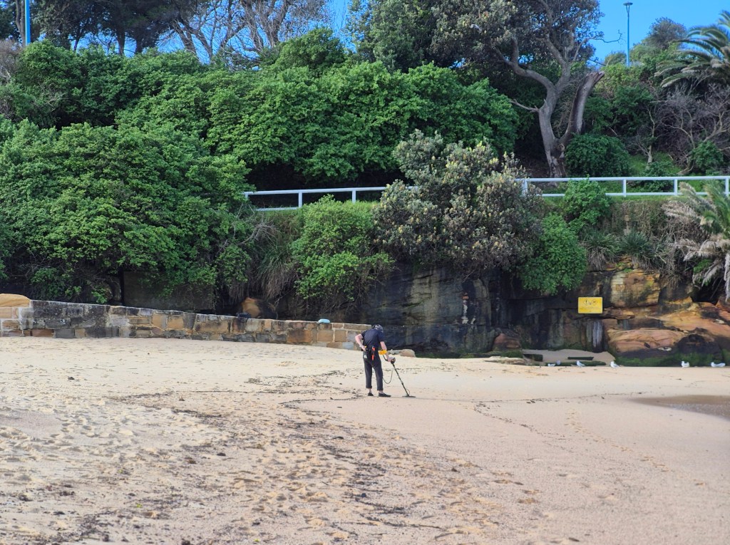
Looking to the left. It’s all beach to the headland, then beaches and beaches for thousands of kilometers.

I ate at a nearby hotel, full English breakfast for $AUS 35 (NTD 700). Sydney may be gorgeous, but it’s also expensive. Then I took the ferry back to Circular Quay.

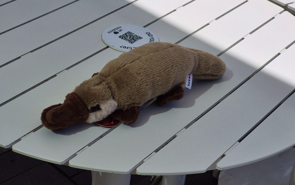
For Yíyún (宜芸) from a tourist shop in Circular Quay I bought a plushy platypus, “a small amphibious Australian mammal noted for its odd combination of primitive features and special adaptations, especially the flat, almost comical bill that early observers thought was that of a duck sewn onto the body of a mammal.” I’m told that in London a preserved platypus has incisions around its bill – a scientist was trying to find the stitches.

While waiting for my bus back to Northbridge I had a quick snack at a cafe in Clarence St in the CBD. While waiting for my meal I watched as an ibis fished out a paper bag using its beak (above). An alternative name for the ibis is “bin chicken”, quite appropriate.

My meal, a chicken sandwich and a long black coffee. Total cost $AUD 20 (NTD 400), cheap for Sydney.

Datong District, Taipei

Note: I will be travelling to Thailand and Cambodia in February 2026. If you are interested in meeting there, even if only for a week or two, respond in the comments below.

August 10, 2025

Jenny is coming to Taipei.

I met Jenny 35 years ago, when we were both undergraduates at Sydney University. She is the sister of Danny, of the Pathologically Polymathic website.

She will be staying in Datong, just north of the terminus of the Airport Line (above), beyond the northern edge of the old city walls. I’ve never explored that area, so I wanted to check it out.

Above is a Google Maps plan of the area. Starting from the Airport Line gates, I planned to walk north to find Jenny’s hotel, “CHECK inn Express – Taipei Station” (雀客快捷 – 台北車站). I was interested to find a market, Jiancheng Market (建成市場) just near the hotel, so I planned to check that out. Google Maps recommended a vegetarian restaurant, 珍巧麻辣臭豆腐(素食 (no English name) which serves stinky tofu, so I wanted to eat that as well.

On Sunday I heard there was a typhoon approaching, but there’s no evidence of it. This morning there were blue skies turning cloudy, temperature in the high 20s Celsuis, increasing to low 30’s as the morning progressed, and quite humid; there would be a shower in the late afternoon.

Eating my breakfast from the 7-11 in a bus shelter outside the Qizhang MRT station (above). I ate strong Americano coffee (the closest I could come to a long black) in my reusable plastic bottle, a minced fish sandwich, and a mixed salad with nuts.

I took the MRT from Qizhang to Beimen MRT stations. Beimen means “north gate”, and nearby there’s the original North Gate still standing in a traffic circle.

From the Beimen MRT station I walked eastwards around 500 meters underground, paralleling the Taipei City Mall. I came to some check-in desks for some of the airlines at Taoyuan Airport (above). The airlines let you check in here rather than the airport.

There was a large screen showing the departure and arrival times of the aircraft.

Across the concourse there was a taxi rank, convenient for anyone emerging from the Airport Line.

Passengers arriving on the Airport Line in the basement can come up the lift or the escalators (upper far left in the photo above), pass the gates (lower far left) leading out of the Airport Line, and turn left into the Taipei City Mall (far right).

They then walk down this long corridor above, and turn left where the “Y16” arrow is.

They then walk down another passage and exit through Y16.

They cross a long corridor with shops to the Y13 exit with escalators.

Riding the escalators brings them to the Y13 exit above. The street through the windows is Taiyuan Road (太原路).

They walk down the stairs, or in the case of someone with luggage, the sloped path.

Taiyuan Road (太原路)- the hotel is a few hundred meters away, on the left.

They walk through the colonnaded shops, cross a large intersection…

… and the hotel (above) is only a few meters along. There is a reception area by the front door. The total distance is 530 meters.

Another view of the Check-inn Express hotel, by Google Maps. The rooms look very small and there’s no attached restaurant, but it’s got good reviews, and it’s cheap – about 1350元 / $AUD68 / GPB34.

I wanted to check out Jiancheng Market (建成市場) close by. I walked the short distance to the cross-street and turned right. The market is in the centre of the photo, almost hidden.

This is the market. It’s in the narrow lane running parallel to Taiyuan Road, but the market goes quite a long way back.

A different photo showing the narrow path. Only a few shops were open. Where is everybody? I expected the market to be bustling. Google says it’s a morning market, and these photos were taken around 10:30am on a Sunday, but it’s very quiet.

The few shops that were open looked appetising, like this one…

…and this one.

I went to YouTube to find a clip of Jiancheng Market, but I found only this clip above. It’s all in Chinese. It looks like a segment of a TV show, primarily concerned with dish after dish of delicious food. Maybe readers could enlighten us further.

From the Jiancheng Market I walked along Chang’an West Road to the intersection of Chengde Road. I was looking forward to stinky tofu.

“Legend has it that a failed scholar from Anhui province invented stinky tofu by accident in Beijing. One day, the tofu vendor had some leftovers. After storing the pieces of tofu in an earthen jar, he found that they had gone bad but tasted strangely delicious. The dish caught on and even made its way into the Qing dynasty court. Over time, it spread to different corners of China. Eventually, migrants from Fujian province brought stinky tofu to Taiwan, where it remains very popular to this day. …  [One version] is the deep-fried variety. …After being fried to perfection, they’ll typically be served in a paper bowl with a splash of sauce and topped with Taiwanese pickled vegetables (mostly cabbage and a bit of carrot).”

I walked up Chengde Road, looking for Lane 77. The restaurant was number 23 in the narrow lane above, amid bars and other restaurants. Unfortunately the restaurant was closed – what a pity.

There was one interesting old building, Rixin Elementary School (in Chinese):

“Over a hundred years ago, the current site of Rixin Elementary School in Dadaocheng, Taipei, was a low-lying swampland. During the rainy season, the pond often overflowed. In 1917, the Japanese colonial government reclaimed the paddy fields and part of the swampland to create a school, named ‘Dadaocheng Second Public School.’ … In 1945, it was renamed ‘Taipei Rixin Elementary School.’” … The Red Building, the founding commemorative building of Rissin Elementary School, is constructed primarily of red brick. At the time, the school enrolled Taiwanese students. While its scale and grandeur are not as impressive as those of Jiancheng Elementary School, which primarily enrolled Japanese students, the rustic red bricks and arched corridors, set against the elegant lines of the building, imbue the school with a humanistic and classical atmosphere. … The Red Building is an irreplaceable cultural asset and historical building for [Rixin] Elementary School. Constructed of lime, sandstone, and red brick, it has been meticulously maintained, making it a rare sight among Taipei school buildings. In 1999, during the devastating 921 earthquake in Taiwan, the Red Building, a major concern for everyone, remained unscathed, a testament to its structural strength.”

By this time I was starving, so I found a Louisa cafe near Zhongshan MRT station and had lunch there, before going home.

Coogee Beach, Sydney

May 30, 2025

I’m back in Sydney for a week to see my mother. While in the Central Business District in the center of Sydney, on a whim, I decided to visit Coogee Beach.

The route, courtesy of Google Maps, goes by light rail (tram) to Randwick where the tram lines end. Then I would switch to a bus (and a color on the map) to get to Coogee Beach.

The light rail (tram) service, outside the Queen Victoria Building on George Street. I estimated the temperature was in the high teens (18 – 19 degrees), warming up to 20 – 21 degrees. George Street used to be full of traffic and noise, with the roar of engines and blare of horns; now it’s quiet and almost serene with the low rumbling of the tram wheels.

On the tram, looking back. Sydney has a growing light rail network; there is a map here.

We went through the center of the city, past Central train station (the photographs weren’t usable) and then Surrey Hills. Above is a row of late 19th century terrace housing, quite common in a ring around the city. I lived in quite a few of these terrace houses during my time at Sydney University.

I changed trams at Moore Park (above), convenient for the Sydney Cricket Ground, out of sight beyond the trees.

Across Anzac Parade there are Sydney Girls’ and Sydney Boys’ High, both selective schools. The enormous trees are Moreton Bay figs:

Ficus macrophylla, commonly known as the Moreton Bay fig … native to eastern Australia … called a strangler fig because seed germination usually takes place in the canopy of a host tree, where the seedling lives as an epiphyte until its roots establish contact with the ground, when it enlarges and strangles its host, eventually becoming a freestanding tree by itself.”

I boarded a different tram and took it past the vast Royal Randwick racecourse, just visible in the distance, overlooked by the member’s stands. The school-aged boys in the foreground are from some private school.

The tram passed the University of New South Wales (above). I spent almost seven years there, studying for a Masters by research. It should only take two years, but I was disabled from the stroke. UNSW is part of the prestigious “Group of Eight” research universities in Australia.

Another view, this time coming back from Coogee Beach.

We rumbled along past the Prince of Wales Hospital:

“The Prince of Wales Hospital is a 440-bed major public teaching hospital located in Sydney’s eastern suburb of Randwick, providing a full range of hospital services to the people of New South Wales, Australia. The hospital has strong ties to the adjacent University of New South Wales. The Prince of Wales Hospital shares the Randwick Hospitals’ Campus site with the Sydney Children’s Hospital and the Royal Hospital for Women, as well as the Prince of Wales Private Hospital”

Shortly we were at the Randwick terminus at Five Ways intersection.

Getting off I noticed an advertisement for China Airlines, the same airline that I had been using to get directly to Taipei. Of course, people would assume it is a Chinese airline – it’s in the name! In fact China Airlines is a Taiwanese airline, the flag carrier for Taiwan, and not a Chinese airline at all. There is a totally different airline called Air China that is not associated with China Airlines at all.

A view of Randwick from the station looking north.

I walked a hundred meters and saw a bus stop – and a view of the sea!

The 370 bus came in a few minutes. This is a photograph from my seat.

Quite a nice view out the windows.

The 370 bus deposited me only a hundred meters from Coogee Beach. What a view! This was taken looking south.

And this photo was taken looking north at around the same spot.

Next stop: South America.

Another view of the beach. I went a little crazy with my photography – but with these views, who could blame me?

A close-up of some seagulls.

There was a Aboriginal fair on, with amplified voices in the distance.

A man with a didgeridoo!

“The didgeridoo … also spelt didjeridu, among other variants, is a wind instrument, played with vibrating lips to produce a continuous drone while using a special breathing technique called circular breathing. The didgeridoo was developed by Aboriginal peoples of northern Australia at least 1,000 years ago, and is now in use around the world, though still most strongly associated with Indigenous Australian music.”

Here is a YouTube clip of a didgeridoo being played. In the early 90’s I used to own a didgeridoo, and patiently developed the knack of circular breathing.

In the center of this photo are tall (3 meters) curved pipes in a ring. When you get out of the sea, you are all salty, so the purpose of the pipes is to wash yourself off.

I ate at Chish n Fips, less than 100 meters from the beach, a casual place with cheap food. I naturally ordered fish and chips with a side salad; it came to $AUD17.50 – about 350元. Unfortunately my photograph of my meal was unusable.

Afterwards I headed to the headland north of Coogee Beach. On the way I took this photo of some sunbathers.

There was a woman using a metal detector on the beach, systematically swinging it from side to side as she walked along.

On my way up I passed this little site, sacred to the Virgin Mary – presumably a Catholic religious site. It’s been there for years, since I first came.

Up on the headland there is a memorial to the 2002 Bali bombings. A plaque recounts the horror, followed by a list by name of those in the local area who perished.

This photo is a neat juxtaposition, contrasting the danger sign with the two (presumably) tourists perched high on the rocks, well outside the safe zone, with nothing but a vertical drop separating the two from the crashing waves.

The view from the headland is even greater than the view from the beach. In this photo I’m looking at the headlands south of Sydney.

And this is a photo looking north, to Gordon’s Bay and Clovelly. What a view!

A photo of Coogee Beach from up on the headland.

Coming down off the headland and walking to the bus to take me home, I saw the Mad Monkey Hostel.

I idly thought, What if I spent a few nights in the Mad Monkey Hostel, swimming at the beach and lazing around the cafes? So I looked at Mad Monkey Hostel online. It’s about $AUS65 per night for a four-bed dormitory in low season – a little expensive, about the same price as the hostels in the city center. Accommodation in Sydney is not cheap, especially when next to a beach.

I rushed to catch the 370 bus. This photo was taken as we left the Coogee shopping center.

On the tram back in central Sydney, atop a white building, I snapped these flags, and below them Chinese characters. That’s the home of the Chinese Nationalist Party of Australasia, a Taiwanese outpost. I covered this in a webpage.

Then I went back to Northbridge to write up my day.

Want to go to Thailand or Cambodia?

From December 2025 to February 2026, I will be in Thailand and Cambodia.

The reason is that I will reach the end of the Taiwanese government’s two-year Chinese language qualification in December. So, I will take a three-month holiday in South-East Asia, then in February come back to Taiwan and re-enroll at the same Chinese language course I am now on.

If you are interested in going to Thailand or Cambodia at that time, please contact me. I could adjust my route to meet you for a few weeks. If you want to see the ‘lost’ city of Angkor, or the charming riverside of Phnom Penh, or the street food of Bangkok, give me a call. I have been to most places in those two countries, and enjoy showing them to travelers.

I will keep posting on Wandering Richard in the three months I will be in Thailand and Cambodia.

Dajia Mazu

April 5, 2025

While I was shopping at Huì Guó Market, someone mentioned the Mazu pilgrimage, a huge festival down south near Taichung. I was unenthusiastic, but I said to myself, in a few years I’ll be glad to have gone. So I looked up the temple and found a “Dajia Mazu Pilgrimage Day Tour from Taipei” – the tour was cheap, so I booked it.

Wikipedia says “The Dajia Mazu Pilgrimage is an annual celebration of the Taoist sea goddess Mazu held in Taiwan. During the festival, a statue of Mazu is placed in a litter and carried by foot on a round-trip journey from Jenn Lann Temple in Dajia, Taichung to Fengtian Temple in Xingang, Chiayi, stopping at many more temples along the way. The festival lasts for nine days and attracts large crowds of pilgrims.” We were only going to participate in the first day.

The day, April 5, was grey and gloomy, threatening rain; the temperature was around 18 degrees. The tour began at 7:30am in the park next to Zhongxiao Xinsheng MRT Station. The above photo was taken on the MRT station steps.

It ended up being two groups, the English and the Chinese languages combined, for 6 people; an extra person was added at Taichung. Above you can see the whole group, minus the tour group leader, at Jenn Lann Temple in Dajia.

We set off for central Taiwan. The rain began as we left. The trip took around 2 hours, not including stopping at a roadside service centre on the way there.

A photo of the mountains from the national highway. As we went south the weather improved slightly; it was no longer raining.

The high-rise buildings of Taichung. We went right into downtown to pick up our last passenger.

Then we left Taichung heading north-west, climbing to a ridge then down a great slope almost to the ocean. The scenery became almost rural (above).

A close-up of the rice-plants.

The bus let us off near the pilgrimage route (above), and we walked to the pilgrimage route.

Wikipedia says “Before the procession departs, a ceremony known as jiaogao (筊筶) is held at Jenn Lann Temple, where the pilgrimage’s start date through poe divination. Afterwards, the procession’s Head Banner is tied onto the left dragon pillar of the temple, rectangular pieces of paper known as a xiangtiao (香條) are passed along the route to notify people about the upcoming pilgrimage, and subordinate temples decide among themselves which order to travel inside the procession.”

I could see a great many people lining the pilgrimage route (above, with a canal).

The pilgrimage route. There were a lot of people, thousands upon thousands, but very orderly for a large crowd. There was a large police presence. To my surprise, Wikipedia says “Since Dajia Mazu is considered to be very powerful, temples along the route would often try to ‘steal’ some of Mazu’s power, which is believed to be inside the incense that is carried. Spiritual power may be ‘stolen’ by others if the incense is surrounded by foreign banners and magical writing. In early pilgrimages, there was a twelve-person convoy holding an incense carrier who travelled in secret to avoid losing the spiritual power in the crowd. However, in 1987, the convoy was intercepted by a temple in Qingshui who tried to redirect them to their temple, so Jenn Lann Temple abolished the convoy in later pilgrimages….In modern times, temples that Mazu doesn’t visit will sometimes send people to surround the litter and forcefully ask them to make a detour to their temple. In most cases, the litter bearers concede to these requests in order to avoid conflicts. However, violent brawls do occur if the two sides do not come to an agreement. Therefore, the procession is often accompanied by a large police presence to discourage litter stealing.”

It was very organised, with regular booths at intervals, like the above. Wikipedia says “Pilgrims often follow a vegetarian diet for the duration of the pilgrimage, and food is provided for passing pilgrims by the villages along the way.”

Burning hell money. “The term refers to imitation money, made of paper, in the Chinese world for burning to the ancestors. The act of burning it serves as the means of conveying the value to the other world for use there.”

A photo of an offering; note the hell money to the right.

A photo of a float. The tour guide said the palanquin containing Mazu’s image was still a mile away.

There were these people dressed alike holding replica halberds. Sorry about this out-of-focus photo.

At last – the palanquin! It’s on the left hardly in view; that circular arrangement you can see is a foretaste. The smoke is from fireworks set off down the road.

The palanquin, surrounded by a jostling, camera-wielding crowd.

You can’t really see it, but the palanquin is moving over the top of the crouching people. Wikipedia says “The kneeling ritual (Chinese: 鑽轎腳…) is a common practice among Mazu processions. Worshipers may either kneel on the ground for the litter to travel over them or crawl underneath a stationary litter. Originally used to show gratitude towards Mazu, worshippers may also kneel to ask for protection and good luck.”

A TV report from last year. That temple is where we’re going next.

In the wake of the palanquin we joined the procession, and walked for several kilometers amongst the crowd. I chatted with an American woman, who asked what I thought of President Trump’s antics.

Eventually we reboarded the bus and travelled a short distance to Dajia. There I briefly left the tour because I was very hungry. I ate at the above restaurant.

My meal, on a paper plate: cabbage, greens, eggplant, and fish, for NTD 90 ($AUD 4.50). It was delicious.

Just up the road was the Jenn Lann Temple. Round Taiwan Round writes “Dajia Jenn Lann Temple (大甲鎮瀾宮) in Dajia District is one of the most well-known Mazu temples in Taiwan, dedicated to Mazu, the guardian goddess of the Taiwan coast. The temple attracts a large number of worshippers throughout the year.”

A different view of the entrance-way. According to Wikipedia, the temple originated in 1730 as a small temple.

The entrance-way. Wikipedia says “The day before the pilgrimage, a ceremony known as qi’an (祈安) is held at Jenn Lann Temple to ask for a safe journey, and Mazu is invited to board the litter. The litter contains three statues of Mazu: zhengluma (正爐媽), fuluma (副爐媽), and meizhouma (湄洲媽). During the pilgrimage, Mazu litter is carried by eight men and travels near the end of the procession, behind the crier, flag bearers, musicians, and convoys from other temples.”

Detail of the carving.

The temple still had a bustling air.

A different angle.

Round Taiwan Round writes “There are also many must-try local snacks near the temple entrance, such as crispy taro balls from Wujia Land and Ji Jia Le Taiwanese meatball. The adjacent Jiang Road Tourism Night Market, which has developed alongside Dajia Jenn Lann Temple (大甲鎮瀾宮), is also a highly recommended place to visit.”

Then we reboarded the bus and travelled the 2 hours back to Taipei.

Sydney Opera House – from Wandering Richard (http://wanderingrichard.com)

February 28, 2025

I’m back in Sydney for a week, between MTC Chinese courses. I’m staying with my parents. My mother has just finished the initial period of chemotherapy; I went with her to her last session.

I thought I’d see Sydney as a visitor would see it. Being born in Sydney, I didn’t get to do any of Sydney’s attractions. In particular, I’ve never gone on a tour of the Sydney Opera House. My mother bought me a fancy mobile ‘phone, so this was an opportunity to learn its functionality.

The above is a detail from Google Maps, showing the Opera House (in a pink circle) on the northern tip of the Sydney Central Business District, across from the Sydney Harbour Bridge.

Above is the Sydney Opera House, as I walked north. It’s in a ridiculously pretty location, with Sydney Harbour on three sides.

The Opera House is on Bennelong Point.

The white “sails” of the Sydney Opera House. It’s a striking modern building, even though it was begun in the 1950’s.

A nod to the traditional owners of the land on which the Opera House sits.

At the foot of the monumental stairs.

Standing at the top of the stairs, looking south to the Sydney skyline. Circular Quay (pronounced “key”) is in the middle of the photo, along with a yellow and green Sydney ferry tied up alongside the wharf. A new cruise ship, the Queen Anne, is to the right.

A view of the Sydney Harbour Bridge.

I experimented with my camera on my mobile ‘phone, capturing a wide-angle view (3x larger) of the Opera House and the Bridge together.

Likewise, I took a wide-angle view towards the east. That land across the bay is Garden Island, a military base; tied up is a warship.

“Garden Island … has been associated with the defence of Sydney and eventually Australia, since the first fleet of convicts arrived in 1788. … possibly its best kept secret is its spectacular 360 degree view of Sydney from the top of the old signal station… Access to Garden Island is restricted, due to it being a military base.”

You can go in the Sydney Opera House quite easily. I became a little lost going along the various levels. I came across Jørn Utzon‘s sketches for the Opera House (above).

At last I found the departure point for the guided tours. The English guided tour were all booked out that day, but fortunateIy I booked a few days’ previously.

The attendant printed out a physical ticket. I selected a “concession” ticket but they didn’t seem to check – but maybe it was obvious to them, since I needed a cane to get around.

I was more than an hour early, so I ate something while looking at the view.

Above is a YouTube clip giving the true story of the building of the Sydney Opera House.

As recounted in this BBC article, “The idea to build an opera house for the city had been proposed in the late 1940s by an acclaimed English conductor, Sir Eugene Goossens. At the time, Goossens was something of a celebrity in the classical music world, having carved out a successful career in the UK and the US… Throughout the 1950s, Goossens lobbied hard, trying to turn his dream into a reality. … Goossens convinced the Premier of New South Wales, Joseph Cahill, that an opera house would reshape the world’s view of Australia, that he had found the perfect site for it, and that they should launch [an architectural competition] … [But] Goossens himself would not get to see his ambition realised. In 1956, having just picked up his knighthood in the UK, he was detained upon his entry back into Australia, where his bags were searched and found to contain, among other things, smuggled pornography, compromising photographs and rubber masks. The resulting scandal … completely scuppered the conductor’s career in Sydney. He fled the country for Rome … never to return.”

The tour group waiting area. The tour groups were classified according to language: the above pillar marked “1” is where the English language tour groups started from. Just beyond is the pillar, obscured by patrons, marking the French, German and other European languages’ tour groups. Further away is the pillar marking the (simplified) Chinese-language groups, and a different pillar marks the Japanese and Korean tour groups. We were warned that photographs would be prohibited inside certain rooms.

We collected round our pillar, were given a headset, and followed the tour leader (above). I estimated there were approximately 30 people on the tour.

As this BBC article continues, “a panel of judges evaluat[ed] some 233 submitted entries. At the start 1957, the government announced that a largely unknown Danish architect, Utzon, was the unexpected winner. Part of the surprise at Utzon’s success was that his entry had largely consisted of preliminary sketches and concept drawings.” Sydneysiders called it the Danish pastry. “Premier Cahill, worried that the project might be derailed by adverse public opinion or political opposition, pushed for construction work to start early. This was despite the fact that Utzon was still finalising the building’s actual design, and had yet to resolve critical structural issues. … The initial estimate of the final cost of the Sydney Opera House was put at A£3.5m or A$7m”.

The inside of the shells were oddly cramped, justified in that the passages and steps were shoehorned into any available space between the halls and the shells (above).

As this BBC article goes on, “the first of the project’s delays and eye-watering extra costs” was lack of a strong foundation. “Nobody had also fully understood the scale of the engineering challenge that the Opera House’s daring curved roof surfaces presented.” Delays and costs mounted; “the project was dogged by labour disputes, design changes and rising material costs, making its budget balloon and its potential completion date disappear into the distance.”

There were opportunities to photograph the view (above).

As the BBC article said, “Robert Askin, who had vocally opposed the project, was elected the New South Wales Premier. He appointed Davis Hughes as the new Minister for Public Works, who clashed repeatedly with Utzon. Hughes, determined to rein in spending, began to challenge the architect’s costs and schedules, demanding a full set of working drawings for the interiors – the next stage of the project. … Hughes refused the payments demanded by the construction team, which left Utzon unable to pay his staff. In 1966, the Danish architect resigned from the project and left Australia, never returning to see his Opera House completed.”

A different view of outside.

As this BBC reports, “Hughes appointed a new panel of Australian architects to complete the interior as well as the glass walls. But if Hughes thought this would reduce costs and speed up the project, he was very much mistaken. The new team scrapped most of Utzon’s plans for the interior and radically redesigned it. … The Sydney Opera House’s spiralling bill was pushed even higher when a labour dispute by union workers, over the dismissal of a worker and demands for better wages, culminated in a sit-in strike at the site in 1972. … But the following year, the monumental undertaking that was the construction of the Sydney Opera House was finally completed. Ten years late and 14 times over its initial budget, it came in at a cost of A$102m (£51m). It was formally opened by Queen Elizabeth II on 20 October 1973. … Utzon declined to attend its opening”. 

Dresses from a production, located in an awkward location near one of the shells.

As this BBC article said, “In the years since its completion, acclaim for Sydney Opera House’s visionary architecture has only grown. Its distinctive sculptural form has made it one of the most immediately recognisable buildings in the world. More than 10.9m people visit it annually, and it has come to epitomise the Australian national identity, its soaring roof a celebration of creativity, culture and ambition in the face of seemingly insurmountable odds. … In 2007, the building that had been brought about by a combination of art, engineering and sheer bloody-minded perseverance was formally recognised as a World Heritage Site by Unesco.”

Unfortunately photography was forbidden in the main opera hall, though not the recital hall (above). Very impressive for a 50-year-old chamber!

The group tour lasted about an hour. I was impressed by the mobile ‘phone’s new cameras; no blurring or out-of-focus images at the sides. Selecting one of the three cameras made it more easy to take photos. I went home impressed with my mobile ‘phone’s capabilities, but even more affected by the Sydney Opera House.

Raohe Street Night Market – from Wandering Richard (http://wanderingrichard.com)

January 27, 2025

新年快樂! (xīn nián kuài lè) – Happy Lunar New Year!  Last night at midnight I heard fireworks ushering in the New Year on the 29th. I got up from my bed and stood on the balcony over the Xindian valley, watching a few sites lit by fireworks, out of time to the distant bangs.

The Mandarin Training Center was closed this whole week. I met with my mother in a Zoom call to check on her. I planned on making a Wandering Richard webpage, and realized I hadn’t put it in going to a night market. Raohe Street Night Market was a convenient choice, on the end of the Green line at Sōngshān (松山, “Pine Mountain”) Station.

Unfortunately, I picked up a virus on Sunday, the day I meant to go. So I went to bed, and the next night, Monday, January 27, I thought I was recovered enough to go. I underestimated the virus, how it made me feel tired and grumpy for many days afterwards.

Another factor was the weather. When I visited the markets it was in the middle of a cold snap. After I got back from the night market I checked the temperature on my computer and it was 8 degrees Centigrade. I know some of you are scoffing at that, particularly if you live in England. But Taipei is only a few hundred kilometers from the Tropic of Cancer where the tropics begin; in Australia it would be on the central Queensland coast north of Brisbane. Eight degrees are as cold as I’ve known it in Taipei since I moved here in 2019. I wore my puffer jacket when I left for the night market.

Above is the Google Maps version of my route. I will be taking the MRT Green line from Qizhang Station (七張站) to the end of the line at Sōngshān Station. The night market is just a few minutes’ walk.

The obligatory MRT train to the night market. I like riding on trains, something I share with Ben Groundwater’s children.

The turn style at Sōngshān Station, with the direction board indicating Raohe Night Market.

I followed the directions, and found – wait, that’s not it! For a while I wandered aimlessly, retracing my steps.

Then I stumbled on a temple (above).

That’s the Sōngshān Cíyòu Gōng (松山慈祐宮), or Cíyòu Temple. I was worried that I wouldn’t find a YouTube clip dedicated to only the Cíyòu Temple, but I found a couple, one of which is above.

There were more people in the Cíyòu Temple when I was there (above). According to Taiwan: Waves of Wonder, “This temple, built in the mid-18th century, is the cradle of development of the Songshan district. The story goes that a monk once roamed this area, carrying a gilded image of Mazu, Goddess of the Sea, as he begged for alms. One day at Xikou—the old name for this district—the monk came upon a number of people, all Mazu believers, from his old home. Together they planned construction of a temple to honor the goddess, and after raising funds for more than 10 years they were able to realize their dream. Construction started in 1753 and was completed in 1757.”

New Taipei City Travel said “The deity statues in the temple, including Mazu, Qianliyen and Shunfenger, have been here for several hundred years. They have witnessed the rise and fall of this place and can stir up visitors’ nostalgia about the old days.”

There was food laid out (above) on long tables, but I didn’t understand the meaning of the offering. Perhaps someone could explain it?

A nice photo of the doors (above).

Moon blocks. According to Gods of Taiwan, “Prayer in Taiwanese Popular Religion is a quite specific and practical affair. It is often used to help the faithful make decisions, be they major or minor, as well as to ask for help from the gods. A prime motivation for a visit to the local temple is to find the answer to a particular question, and to find that answer, adherents will turn to the divination tools of their faith, jiao bei [Moon blocks] … The question also must be phrased very clearly, and due to the binary nature of the jiao bei, must only be answerable with yes or no. The two blocks are then tossed onto the floor, and how they fall will reflect the answer.” There are four different results, either yes, no, undecided, or ‘laughter’ – “interpreted as the gods laughing at the proposition, either because it is a particularly bad idea, because the enquirer has already decided, or the question lacks relevancy in some other way”. Read the article, it gives a great insight into people’s perception of the gods.

The inside of a temple roof. According to Taiwan: Waves of Wonder, “The top of the temple roof is richly ornamented; in addition to human figures, there is also a flying dragon placed there because dragons were believed to have the power to prevent fires. Inside the temple are layer after layer of oil lamps lighted by devotees in the hope that Mazu will grant their wishes. The side altar to the right of the Mazu image enshrines the Earth God, who is protected on either side by flag-gearing Tiger Lords. The side altar to the left is devoted to Zhusheng Niang-niang, the Goddess of Birth. This goddess is normally accompanied by 12 female aides, but here she has 13. The extra aide is Duyu Niang; in life she was a midwife who never accepted money for helping women with childbirth, so after death she was deified because of her kindness and skill.”

The above is a photo I took of an interpretative sign, which is mostly legible. My camerawork is rubbish.

Right next door is the Raohe Street Night Market – in traditional Chinese characters 饒河街觀光夜市, “Raohe Street Tourist Night Market”.

Yellow Productions has a clip on the Raohe Night Market. I like the presenter, he has quirky and interesting things to say.

I joined the crowd of people and was moved along by them. Above is a stall in a long double line of stalls in the middle of the street.

There were many drink stalls (one of which is above). A great idea in summer after a hot and humid day; not so much in winter, with the temperature in single digits.

There were quieter streets off the central road (above).

My impression of the night market was crowded, jostling people, and overwhelming noise. I realized I didn’t like it one bit. Of course I had the virus, which shaped my perception quite a bit.

I bought a 刈包, “guàbāo” (above) from a stall. I ate the guàbāo standing, as there wasn’t anywhere to sit down.

From Wikipedia, “Koah-pau or gua bao… or cuapao… also known as a pork belly bun…, bao,… or bao bun, … consists of a slice of stewed meat and condiments sandwiched between flat steamed bread … typically 6–8 centimetres (2.4–3.1 in) in size, semi-circular and flat in form, with a horizontal fold that, when opened, gives the appearance that it has been sliced. The traditional filling for gua bao is a slice of red-cooked pork belly, typically dressed with stir-fried suan cai (pickled mustard greens), coriander, and ground peanuts.” According to the MOFA Taiwan, “In those days of material poverty, pork was a rare treat, so people had the chance to eat gua bao only on special occasions like year-end banquets or when venerating the local earth god. … It was not until the 1970s that gua bao became widespread in the daily lives of ordinary people.”

Finally the cold and the virus overcame me, so I headed for home on the MRT, and went to bed. As I write, three days later, I still feel the virus.

Wat Pho, Bangkok – – from Wandering Richard (http://wanderingrichard.com)

January 13, 2025

I’m in Bangkok, with Wren who was my tutor in Chinese, and Ben her partner.

I made the airline bookings half a year ago, booked the hotel room well in advance, and paid for my travel insurance. I was really looking forward to the holiday in Bangkok. Then, only a few weeks ago, my mother was diagnosed with advanced ovarian cancer. I immediately started to book my airfare home, but my parents were strongly against me coming back. My father said this is a sustained effort over years, a marathon not a sprint. Over Zoom, my mother said that she was inundated with offers of assistance, and me coming back to live with her wouldn’t help. So, very reluctantly, I stayed in Taipei, and went on this trip. I still will be going back home in a little over a month.

I noticed that the internet censorship in Thailand are increased. YouTube is blocked, so I have to update this blog with a YouTube clip back in Taiwan. My Australian bank is also blocked, for reasons known to the Thai authorities but not to me; I do my banking over the Internet so this is an annoyance for me. The Sydney Morning Herald, an Australian newspaper to which I have an internet subscription, is blocked as well. Oddly, VPNs are not blocked, so I could use a VPN to get around all this.

My route, courtesy of Google Maps. I went on the BTS from Ratchatewi BTS station to Saphan Taksin BTS station on the Chao Phraya riverbank, then caught a riverboat to Tha Tien pier, next to Wat Pho, in the heart of the old city next to the Grand Palace. There was an easier way to arrive, on the MRT to Sanam Chai MRT station convenient to the old city, but I wanted a ride on the riverboat.

My room at the Asia Hotel. I booked a long way in advance and secured the room for $AUD55 a night. The Asia Hotel is rumoured to be haunted; TraveMyth says: “Asia Hotel in Bangkok is believed to be one of the most haunted hotels in Thailand. Apart from its general spooky and misty atmosphere, some guests have reported hearing crying sounds coming out of the bathrooms, feeling someone touching them when they sleep or seeing strange apparitions wandering around”.

The Ratchatewi BTS station above Phaya Thai Road. Note there is a spirit house at the far left. There is an entrance-way directly into the Asia Hotel. I left the Asia Hotel early, about 7am. On this day the weather in Bangkok was remarkably cold, around 20 degrees Celcius – chilly for Bangkok!

On the platform high above the road, waiting for the BTS train. I was supposed to change trains at Siam BTS station, but I was too busy photographing the scenery and forgot. A quick round of trains put me right.

At the Saphan Taksin BTS station, and my first glimpse of the river.

I bought my breakfast at the 7-11 but didn’t eat it. As a result by this stage I was ravenously hungry, so had my breakfast at the Saphan Taksin pier, watching life beside the river.

A long-tailed boat: “The longtail gets its name from the trailing drive shaft and propeller at the back of the boat. … The engines at the back of the boats are sometimes custom-made, but more often than not they are simply a converted car or truck diesel engine which makes them relatively cheap and easy to maintain. The boatman sits or stands at the back of the boat whilst the passengers sit in front of him on small wooden planks. An overhead canopy provides shade and shelter and some boats also have pull-down plastic canopies that cover the sides to protect passengers from spray or rain.”

Life on the water.

A river ferry letting off passengers.

And here’s my river-ferry! A big step over the side of the boat and down into the front where I took my seat.

A view back aft.

There was some rough water as we roared along.

Nice view of the riverbank.

A prominent spirit house: “you may wonder what are those little buildings in front of your apartment or nearby restaurants? They look almost like miniature temples on pedestals. However, these are Spirit houses, also called San Phra Phum in Thai. San means shrine and Phra Phum means Spirit, God or Angel. Thais believe that protector spirits live in these little houses so they will build one in front of their home or business.”

A framed view of a large wat complex, probably Wat Kanlayanamit Woramahawihan.

The Royal Seminary: “This beautiful ochre coloured building stands on the east bank of Chao Phraya river. It is a Neo-Classical building which was constructed 136 years ago. … after Queen Sunantha Kumariratana drowned in the Chao Phraya River King Rama V built this Sunanthalai Building in her memory.” Wikipedia said “There is an often repeated myth that the many witnesses to the accident did not dare to touch the queen, a capital offense—not even to save her life. However, this was not the case; the King’s diary records that boatmen dived into the water, pulled the queen and her daughter from the entangling curtains, and carried them to another boat, where attendants worked in vain to resuscitate them.”

I disembarked the river-boat at Tha Tien pier and walked a block to Wat Pho (above). The building behind the gate houses the Reclining Buddha.

Wikipedia said “The temple is first on the list of six temples in Thailand classed as the highest grade of the first-class royal temples…. It is associated with King Rama I who rebuilt the temple complex on an earlier temple site. It became his main temple and is where some of his ashes are enshrined…. The temple was later expanded and extensively renovated by Rama III.”

Another gate. According to Wikipedia, the statue is one of the Chinese statues that were imported from China as ballast.

A woman worshiping in front of images of the Buddha. Wikipedia said “During its construction [in 1788], Rama I also initiated a project to remove Buddha images from abandoned temples in Ayutthaya, Sukhothai, and various other sites in Thailand, and many of these retrieved Buddha images were then kept at Wat Pho”.

I paid the entrance fee of BTH300; Thais get in free. When I go back to Taiwan I plan to put a YouTube clip here, as YouTube is banned in Thailand – watch this space!

The Reclining Buddha is actually about to die. Lonely Planet said “Located in the compound’s main wí·hăhn (sanctuary), the genuinely impressive Reclining Buddha, 46m long and 15m high, illustrates the passing of the Buddha into nirvana (i.e. the Buddha’s death).” This was viewed as a good thing: the cycle of reincarnation after reincarnation was about to end.

Looking from the head to the feet. When you are in the hall you feel the sheer enormity of the Reclining Buddha. The Civilatis Bangkok said that this is “the largest Reclining Buddha statue in the country. At 150 feet (46 m) long, this gold-plated figure barely fits in the temple that shelters him!”

The view reversed, looking from the feet to the head. At the extreme right you just catch a glimpse of the underside of the feet. Emerald Buddha said “The soles of the feet of the reclining Buddha are exquisitely crafted with inlaid mother-of-pearl shell. At the centre of each foot is a symbol of a wheel (dharma- cause and effect) and representing one of many chakra energy points where universal energy flows into the body. Portioned into 108 sections and displaying auspicious symbols identifying The Buddha, including flowers, dancers, white elephants, tigers and altar accessories.”

Standing next to the hall. Apart from the Reclining Buddha, as Wikipedia said, “The temple is considered the earliest centre for public education in Thailand, and the illustrations and inscriptions placed in the temple for public instructions has been recognised by UNESCO in its Memory of the World Programme. It houses a school of Thai medicine, and is also known as the birthplace of traditional Thai massage which is still taught and practiced at the temple.” I saw none of those things.

Instead, I was going to see Wat Arun, the Temple of Dawn (above). Wat Arun said “It’s one of the most spectacular and recognizable Thai landmarks…. Visitors journey here in pilgrim like status, due to it’s one of few temples you are permitted to climb its main staircase, rewarding the intrepid with panoramic views of the bustling Chao Phraya river, the Grand Palace and Wat Pho on the opposite bank. … King Taksin (1734–82) when establishing the new capital of Thonburi, following the fall of Ayutthaya (previous Thai capital), brought with him from Vientiane, Loas, The Emerald Buddha which was previously housed in one of the two small buildings located in front of the Grand Pagoda.” It ended up in the Temple of the Emerald Buddha.

I took a short ride on a cross-river ferry (above). When I reached Wat Arun, the entrance fee was BTH200. Around this time, my mobile phone camera indicated it had reached the limit of photos; to take new photos I would have to delete some old ones. I was only going to briefly visit Wat Arun, so I decided to skip it, and go back on the cross-river ferry again. I walked past all the attractions the old city had, and went to Sanam Chai MRT station and home.

Phnom Penh, Cambodia from Wandering Richard (http://wanderingrichard.com)

November 23 – November 27, 2024

I’m in Phnom Penh, Cambodia.

Above is a view of the Tonle Sap river, just 100 meters from my hotel, near sunset.

I’m here in the week between the old MTC course finishing and another one beginning. I booked the airfare and the hotels several months in advance, securing early bird discounts. Unfortunately, a few weeks ago, someone committed identify theft on my credit card. Over perhaps two weeks, they added bogus charges, slowly increasing them to avoid alerting the automatic detection mechanism. I eventually realized and cancelled the card, sending the new card to my address in Taiwan. 

Unfortunately, it didn’t come when I was due to fly to Cambodia.  So I was unable to pay for things over the Internet, including my Cambodian visa. I was also unable to use the ATM in Cambodia.  So I didn’t use the financial system in Cambodia at all.

Before leaving, I had withdrawn slightly less than $AUD 1,000. I flew into Phnom Penh International Airport and paid the “visa on arrival” option in cash. Next I went outside, caught a bus to the riverside, and walked to my hotel. I was apprehensive I would have to pay the accommodation bill, but fortunately it was already paid. A big relief!

My room. Not shown is the en-suite bathroom and cable TV. The cost is around $AUD 50 a night. The hotel is downtown, a block from the river. I can walk to the National Museum and Wat Phnom.

Phnom Penh according to Google Maps. My hotel is circled in red. All along the riverside, from Wat Phnom to the ferry crossing (shown in light red) is a combination of hotels, bars, restaurants (both Western and Khmer), and markets. It’s a bustling, lively atmosphere.

General street life. Note in the above photo a “tuk-tuk”, a vehicle mating the front half of a motorcycle with the back half of a cart. The more modern version is in this article.

Above is a view of the Tonle Sap river, this time about 6am.

A different view from about the same location, looking at the meeting with the Mekong River.

There is a market a block from my hotel. According to Google maps, it does’t have an English name, only “នំបញ្ចុកខ្មែរ ឆ្ងាញ់ ឆ្ងាញ់” in Khmer. In the above photo it’s the whole block to the right of the lane, a warren of tiny huts selling groceries or food.

It was busy in the mornings near the market.

While I was taking photos, a guy arrived on his motor-scooter, with a tub of food on the pillion seat. He then proceeded to sell the food (above) off the bike. Note the butcher’s shop in the background, raw meat displayed for sale.

A block from my hotel was this Khmer cafe/restaurant. This quickly became my new favorite place; I ate there almost every morning.

The blurry photo above is what I ate every morning: an iced coffee, a pork bao already eaten, and a beef stew with a baguette:

“Intensely rich, savoury, and a little sweet … something incredibly more-ish that you’ll be eating until the last spoonful and then licking the bowl. Our favourite way to eat it is with a crunchy French baguette”.

One morning I decided to cross the river. I left my hotel, marked with a dark red circle in Google Maps, to take a tuk-tuk down to the Kampong Chamlong Phnom Penh Areiy Ksatr wharf. You can check the Google Maps above, shown in light red.

The photo above is that wharf, with some ferries discharging passengers and motor vehicles.

Preparing to board the ferry. The ferry was pushed up only by the action of the propellers, seen causing turbulence in the left side of the photo. Cars and trucks drove on over the ramp in the bottom right of this photo, as did I. When the ferry was full, the captain reversed the propellers, and we were off.

Nice view, although hot – I estimated over 30 degrees.

There were many other vessels doing the same.

This photo is of the Mekong River, from the Sokha Phnom Penh Hotel on the peninsular to the right, to Kandal Province on the left.

“The Mekong or Mekong River …is the world’s twelfth-longest river and the third-longest in Asia with an estimated length of 4,909 km (3,050 mi)… From its headwaters in the Tibetan Plateau, the river runs through Southwest China (where it is officially called the Lancang River), Myanmar, Laos, Thailand, Cambodia, and southern Vietnam.”

Just even hearing its name exerts a powerful effect on me. In 2008 I traveled up the Mekong River, from its several mouths in southern Vietnam near Ho Chi Minh City, through Phnom Penh, Vientiane in Laos, Luang Prabang, and Jǐnghóng (景洪) in China – 5 months total, over 3,000 kilometers. An interesting (and now, nostalgic) time.

In Areiksart Ferry Port, looking over at the skyscrapers of Phnom Penh.

The view along the road from the Areiksart Ferry Port.

The day was hot, so I stopped at a restaurant. The waitress spoke no English, but I pointed to another customer’s order, resulting in the noodle soup above. The tea was complimentary.

On another day, I went past Wat Ounalom:

“It was built in 1422 by King Ponyea Yat, the last king of the Khmer empire. …Wat Ounalom is recognized as the ‘headquarters’ of Cambodian Buddhism. The patriarch, the chief abbot of Cambodia, resides here. … This monastery was home to over 500 monks and housed a huge library consisting of over 30,000 titles. During the regime of the Khmer Rouge, many of the buildings along with many religious statues and symbols were damaged, but most of which have since been restored. The buildings are used for a variety of purposes. There is the temple itself, schools, libraries, living quarters and the stupa that gives the temple its name; the stupa holds an Ounalum, a hair from the eyebrow of the Buddha.”

I was heading for the National Museum of Cambodia (above). I’ve been a few times so this was a quick visit.

Lonely Planet says: “The National Museum of Cambodia is home to the world’s finest collection of Khmer sculpture: a millennium’s worth and more of masterful Khmer design. It’s housed in a graceful terracotta structure of traditional design (built from 1917 to 1920) with an inviting courtyard garden, just north of the Royal Palace.”

Inside the building. While writing this up I found that “visitors are not allowed to photograph the collection, only the central courtyard” – so the above photo is illegal.

The central courtyard (where photography is permitted) is a very elegant place.

Next I planned to go down to Kampot for the day.

From Google Maps, Phnom Penh to Kampot is 146 kilometers. An equivalent is Sydney to the Hunter Valley. I was taking the train, which meant nearly 4 hours’ travel. I planned to go down to Kampot by the 7am train, spend 5 hours there, and take the afternoon train back up to Phnom Penh. I booked the tickets in person a few days before.

The day of the trip to Kampot, I got up very early, before 4am. Exiting the hotel, a film crew was at work, filming a scene in the middle of the street. Fake pedestrians, fake tuk-tuk drivers, even a fake backpacker took their positions, and on the call of “Action!”, pretended to walk. It was a little over 5am and still dark. I tried to take a photo, but one of the film crew stopped me, so I took this photo from a distance. It was very strange.

The Phnom Penh Train station in the early morning. The website says:

“Phnom Penh Railway Station was constructed during the French colonial era, opening to passengers in 1932. Despite being effectively out of use as railway station for an 11 year period from 2005 to 2016 Phnom Penh Railway Station is a beautifully preserved building from a much different era.”

Behind the station, several trains were waiting. Our train was the one at the left, a single car.

The above YouTube clip gives you a flavour of the ride. I think it’s a Thai train in the clip.

I was on a different train to that clip; the windows didn’t open and it was split about half between tourists and Khmer.

The railcar moved out of Phnom Penh’s suburbs at an estimated 40 kilometers an hour. We trundled on a dead flat plain (above) with relatively scrubby vegetation.

After 2 hours or so, we passed through a line of hills, and the vegetation improved. This was classic Cambodian countryside.

I go off at Kampot and hired a tuk-tuk to get me to the centre of town, beside the river. I paid the driver $US 1.

The Wikivoyage page says: “Kampot’s main draw is its relaxing riverside setting. While there is a sizable town (population approximately 40,000) set back from the river, most tourists will spend most of their time enjoying the river. Most tourist businesses are scattered along the riverside promenade or are within one or two blocks of it. The riverside’s main reference points are the ‘old bridge’, a mongrel of various styles and temporary parts thrown together after its breaching in the Khmer Rouge days, and the French-built market building, which is being restored. Back from the river, the town is centered on the bizarre ‘durian roundabout’ featuring a huge statue of a durian. From where the buses drop passengers, walking down the wide boulevard leads towards the river and the French-built market.”

There were many tourist businesses by the river, including a few Western restaurants and a tourist night market a block from the river. I ate in one of the tourist restaurants (above).

Then I went back to the train station and waited for an hour and a half for the train – I think it was delayed. The train came and I boarded it. A few minutes later, some Khmer passengers boarded and demanded my seat. There was an unoccupied seat only a few seats over; a cautionary lesson on might makes right. I did move, and watched the countryside, and slept, waking up a few minutes before arriving at Phnom Penh Train Station.

I have enjoyed visiting Phnom Penh, and it appeals to me, although I think it’s a little too poor and rough to make living there enjoyable.

Taronga Zoo, Sydney – from Wandering Richard (http://wanderingrichard.com)

August 28, 2024

I’m in Sydney again, for one week while the Mandarin Training Center at NTNU in Taiwan is closed.

Sydney is a really beautiful place, but in my Wandering Richard webpage you’d never appreciate that. The Sydney Opera House, the Sydney Harbour Bridge, Bondi Beach – growing up in Sydney I became used to these places. But living in Taiwan, I now realise Sydney is a gorgeous city. I’ll try to show it off to you, by going to Taronga Zoo.

The Google Map above shows the route. From my parents’ house in Northbridge I took a bus to Wynyard in the Central Business District, changing to a ferry a Circular Quay (pronounced ‘Key’), sailed across Sydney Harbour to Taronga Zoo Wharf.

That day the weather was balmy and very windy; the temperature was around 25 degrees Centigrade. On the wind you could smell the enormous dry hinterland of Australia.

The above photo is of the 206 bus taking me from Northbridge. The time was about 9am. Note the lack of masks – Australians view COVID19 as ancient history.

On the bus as we roared down the Cahill Expressway, a spectacular view outside from Sydney Cove – Sydney Harbour, the Opera House to the right, the Harbour Bridge to the left, a ferry just pulling out from Circular Quay below us.

The National Museum of Australia says “The arrival of the First Fleet at Sydney Cove in January of 1788 marked the beginning of the European colonisation of Australia. The fleet was made up of 11 ships carrying convicts from Britain to Australia. Their arrival changed forever the lives of the Eora people, the traditional Aboriginal owners of the land in the Sydney area, and began waves of convict transportation that lasted until 1868.” My great-great-great-great-great-great grandmother was on the First Fleet, as a convict.

I got off the bus nearby and walked a short distance, under Circular Quay Station, and took this photo facing the same direction (look at the Opera House). When I last visited Taronga Zoo pre-COVID19, the Zoo had a stand at Circular Quay where you could buy a combination entry fee and ferry ticket. Now I discovered it was all online, and since I omitted to bring my Chromebook I would have to pay inflated prices.

YouTube has many, many clips about taking the Taronga Zoo ferry. Here’s one that doesn’t feature an influencer.

Here comes the Taronga Zoo ferry.

I strode up the gangway and to the bows, and took this rather blurry photo. Most of the passengers were from overseas.

The ferry passed the Sydney Opera House.

“The Sydney Opera House is one of the 20th century’s most iconic buildings. It broke new ground for design and engineering around the world. Since its opening in 1973 it has become a symbol the world immediately associates with Sydney and Australia. The story of the Opera House is a drama that for more than 15 years grabbed national headlines and pitted the artistic vision of the architect Jørn Utzon against the politics and budgets of the New South Wales Government and the limits of architecture and construction. … Finally, the Sydney Opera House was opened by Queen Elizabeth II on 20 October 1973. It was 10 years overdue and, at $102 million, 14 times the original budget. However, Australia was now home to one of the greatest buildings of the 20th century – an instantly recognisable piece of exhilarating architecture that remains a credit to this country and one with which Sydney and Australia are instantly associated.” (National Museum of Australia)

The Sydney Harbour Bridge:

“in January 1923 [Bradfield] issued calls for tender for the ‘Construction of a Cantilever or an Arch Bridge across Sydney Harbour’. … The government had to clear hundreds of houses from the northern and southern approaches to the bridge. … A total of 802 buildings were demolished. … In total more than 52,800 tonnes of steel were used; 39,000 tonnes in the arch alone. … Slowly the main span of the bridge was erected by cantilevering the two half arches towards each other from each shore. … On 19 August 1930 the two halves of the arch were joined, making the bridge self-supporting and allowing the cables to be removed. … Load testing began in January 1932 with 96 locomotives lined up end to end across all four of the bridge’s rail tracks. … More than 1,600 people worked on the bridge during the nine years of its construction, providing much-needed jobs for Sydney during the Great Depression. … By today’s standards industrial safety on the work site was poor. During the construction of the bridge, 16 men died. … The official opening of the bridge took place on 19 March 1932. … More than 750,000 people gathered around the harbour for the official opening event. The bridge was to be opened by the New South Wales Premier, Jack Lang. Before Lang could cut the ribbon and declare the bridge open, Francis De Groot, a member of the ultra-right-wing New Guard group, rode a borrowed horse out of the crowd and slashed the ribbon with his cavalry sword. De Groot was arrested. Lang cut a new ribbon, the bridge was declared open, and a public bridge walk took place. De Groot was fined £5. … The cost of building the bridge was £4,238,839, although with the costs of constructing the approaches, the land resumptions, and interest paid during construction, the total cost of the build was closer to £10 million. The debt was finally paid off in 1988. The Sydney Harbour Bridge has become one of the most recognisable icons, along with the Sydney Opera House, of Sydney and Australia.” (National Museum of Australia)

A good view of the Sydney skyline. The island to the centre right is Fort Denison.

“Fort Denison was originally a rocky outcrop to the north of Woolloomooloo Bay, known by its Aboriginal name of Mat-te-wan-ye, also spelt Muttewai or Muttenwaya. Governor Arthur Phillip renamed it Rock Island soon after European settlement to Sydney Cove, but it was informally known as Pinchgut Island. This colourful name is commonly believed to refer to the island’s use as place of punishment for convicts until the early 1800s, and the starvation diet they received there of bread and water. … In 1855 work began again on transforming the island into a fortification … The distinctive Martello tower – to the design of the forts that ringed the British coastline in the Napoleonic wars – was the only one built in Australia. … The Martello tower received some damage during World War II, when it was hit by a shell from the USS Chicago during an engagement with Japanese midget submarines entering the harbour.” (Dictionary of Sydney)

Nearing Taronga Zoo Wharf, just of the above photo on the right. On the left is Whiting Beach. The foreshore is all public land; I’ve stood on that beach.

Taronga Zoo Wharf. The forested area behind it is actually Taronga Zoo.

Disembarking the ferry. Actually, I took this photo going home, waiting to board the ferry.

The ferry in front of the Sydney skyline. I took this photo too while waiting to board the Scarborough ferry; the ferry coming from Circular Quay was the Alexander. The First Fleet class are named after ships of the First Fleet.

Nice view of Taronga Zoo Wharf.

I expected to be transported via gondola, but the Sky Safari has retired. Instead I took the bus (above).

The bus drove a short route to the main entrance on the opposite, uphill, side (above).

Brittanica says “One of the outstanding zoos in Australia, Taronga Zoo opened to the public in 1884 in an area outside Sydney known as Billy Goat Swamp. … By 1912 the original site was no longer adequate, and the state government made a grant of land in Taronga Park, north of Sydney Harbour. The new zoo, comprising some 52 acres (21 hectares), opened in 1916; most of the animals from the old zoo had to travel to their new home via barge”.

I was given a map of Taronga Zoo, similar to the above map. The Australia section is in the north-east corner (bottom left in the above map).

Taronga Zoo was all shady winding alleys between forested blocks, quite attractive.

There were occasional glimpses of Sydney Harbour.

The first precinct I came to had a circular fence enclosing a wide irregularly-shaped area containing emus (above).

The Australian Museum says “The name ’emu’ is not an Aboriginal word. It may have been derived from an Arabic word for large bird and later adopted by early Portuguese explorers and applied to cassowaries in eastern Indonesia. The term was then transferred to the Emu by early European explorers to Australia. … The Emu is found only in Australia. It lives throughout most of the continent, ranging from coastal regions to high in the Snowy Mountains. Emus were once found in Tasmania, but were exterminated soon after Europeans arrived. Two dwarf species of emus that lived on Kangaroo Island and King Island also became extinct.”

Also in this enclosure were kangaroos (or wallabies), resting in the balmy weather.

“No image of outback Australia is complete without a mob of kangaroos hopping across the horizon. Kangaroos belong to the Macropodidae family, meaning ‘big foot’ in Latin (a reference to their large back feet). What’s the difference between a kangaroo and a wallaby? Kangaroos are simply the larger animals in the Macropus genus. … The word kangaroo derives from ‘Gangurru’, the name given to Eastern Grey Kangaroos by the Guuga Yimithirr people of Far North Queensland. Kangaroos are of cultural and spiritual significance to Aboriginal people across Australia. Plus, their meat was, and continues to be, a  staple protein source; pelts were used for clothing and rugs; and their skin crafted into water bags. Kangaroos are the world’s largest marsupials. A Red Kangaroo can weigh  90kg and can grow two metres tall. Black Wallaroos, at around 20kg, are the smallest species. ” (Bush Heritage Australia)

I moved to a different enclosure, this one containing koalas.

“Koalas are not bears. They are not placental or ‘eutherian’ mammals, but MARSUPIALS, which means that their young are born immature & they develop further in the safety of a pouch. It’s incorrect to call them ‘Koala bears’ – their correct name is simply ‘Koalas’ … The AKF estimates that there are likely to be less than 60,000 Koalas remaining in Australia today and it could be as low as 33,000. Much of their habitat has already been lost. This makes it vitally important to save what is left”. (Australian Koala Foundation)

Wallabies! The website for Taronga Zoo says “Wallaby is the general term for medium-sized, hopping macropods found throughout Australia and New Guinea… The taxonomic classification of wallabies is informal, and not universal. Wallabies are macropods smaller than a kangaroo, though this distinction is drawn entirely off their size. By this simple definition, a range of macropods can be classed as wallabies including Quokkas, Pademelons, and Wallaroos, however whether these should be considered wallabies is disputed. There are generally considered to be around 30 species of wallaby…. Some wallaby species are mostly solitary whilst others live in groups called mobs. They feed on a range of low-lying vegetation, though grass is the main food source for most wallabies. Some species can survive on very little water, getting most of it from their diets. Thick undergrowth can provide cover from predators, and their agile hops allow a quick escape even in uneven or rocky terrain. …Wallabies are endemic to Australia and New Guinea, yet due to humans can now be found in several other countries around the world…. New Zealand’s invasive population has boomed to over a million wallabies, causing significant harm to local ecosystems and wildlife.”

An animal I didn’t expect – Tasmanian Devils!

There is a separate small building just to house Tasmanian Devils. The above photo is of the interior of the building; there is a skeleton of a Devil on the bottom right. Sorry about the quality of the photo. There were a number of photos that I couldn’t use because they were too blurry.

The Australian Museum says “The Tasmanian devil is the world’s largest surviving carnivorous marsupial. … Tasmanian Devils were once abundant on mainland Australia as evidenced by fossil remains. Reliable fossil evidence suggests they became extinct from the mainland between 3,200 and 3,500 years ago. They are widespread and common in Tasmania … Tasmanian Devils are mainly scavengers feeding upon the carcasses of dead animals but can also be effective predators. … Their powerful jaws and teeth enable them to entirely devour their food including bones and fur. They are particularly renowned for their noisy communal eating during which use noise and threatening physical displays to assert dominance amongst the pack. … the greatest current threat for devils is the Devil Facial Tumour Disease (DFTD). This fatal condition is characterised by facial tumours and is one of only three contagious cancers ever recorded. It is believed to be transmitted from devil to devil through biting.”

There was a viewing area, but it seemed to be empty of Devils. However I spotted a Devil drowsily lying high up (above).

There was a second separate viewing area in which a second Devil was quite active, clambering about the enclosure, while I agitatedly clicked my phone.

A better shot of the Devil.

“Taronga Western Plains Zoo [linked to Taronga Zoo] became involved in the Save the Tasmanian Devil Program in 2008 when Australian zoos and wildlife parks committed to establishing an insurance population on the mainland. This decision was crucial at that time as an untreatable and fatal threat, the Devil Facial Tumour Disease (DFTD), had spread amongst wild devils through bites, usually obtained during mating, feeding and fighting. Since commencement of the breeding program, Taronga Western Plains Zoo has successfully bred 50 joeys in a dedicated behind-the-scenes breeding facility. The Zoo has now transitioned to an ambassador role within the region for this species as insurance population goals have been met and wild populations are exhibiting a resistance to the disease.” (Taronga Conservation Society).

A YouTube clip of a Tasmanian Devil.

Then I retraced my journey, catching a bus from the entrance to the Zoo down to Taronga Zoo Wharf, a ferry to Circular Quay, and up on the light rail to the Queen Victoria Building, where I transferred to the 194 bus and home.